Yellowknife Garden Metals Study

Yellowknife Garden Metals Study

Main Project Contact: Mike Palmer

Project Start Date: September 2020

Project End Date: March 2022

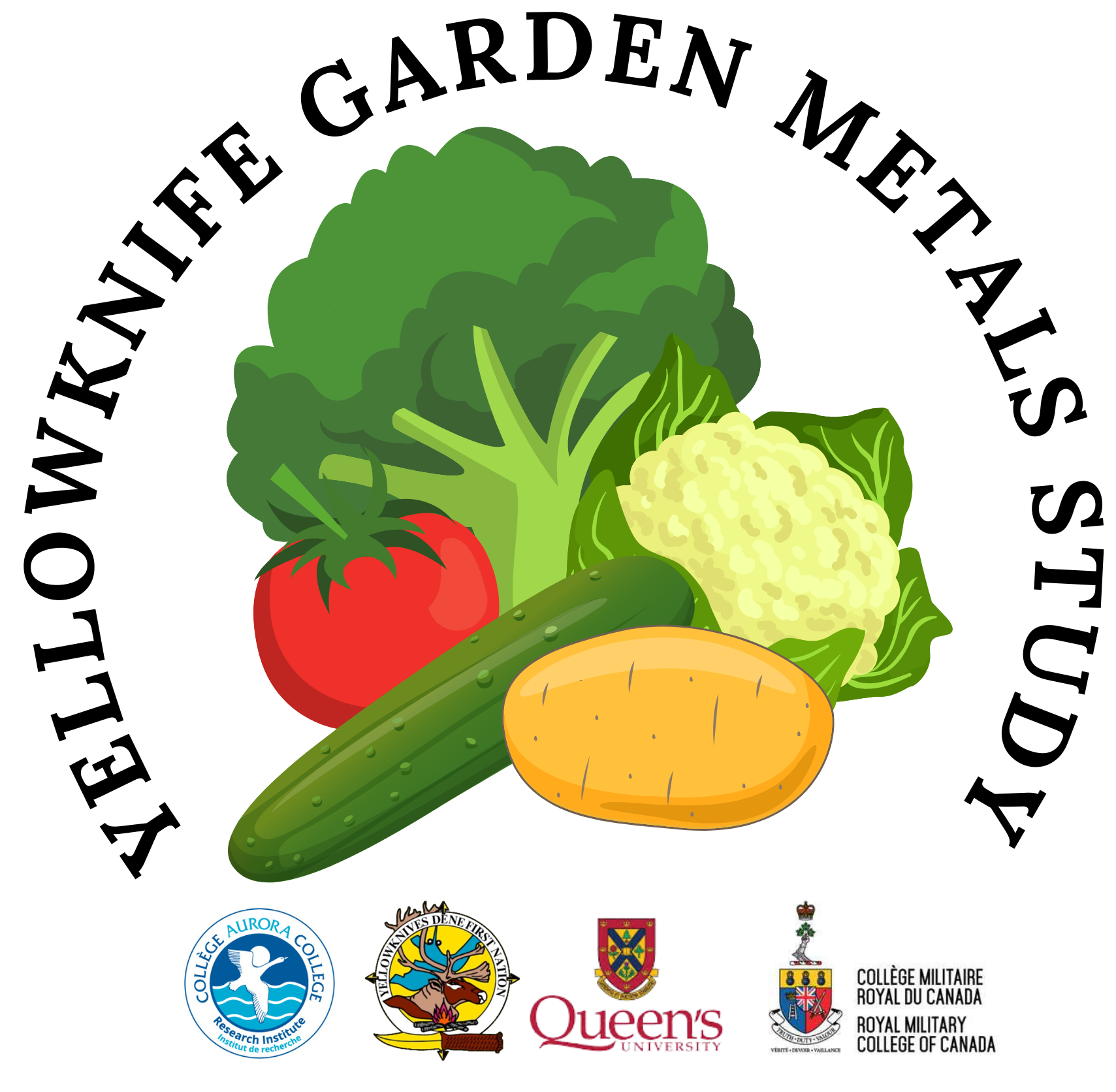
Project Name: Yellowknife Garden Metals Study: Arsenic and Mining Associated Metals in Local Garden Produce in the Yellowknife Area

Overview:

  • The Yellowknife Garden Metals Study (YKGMS) collects information on the amount of arsenic and other mining related contaminants (antimony, cadmium, lead, manganese, copper, zinc, and vanadium) in backyard garden soils and produce in Yellowknife (YK), Ndilo, Dettah and surrounding area. 
  • Studies have shown soils in the YK area are impacted by past mining emissions.  Concentrations of arsenic in soil near YK, particularly near the Giant and Con mines, are higher than other parts of the country.
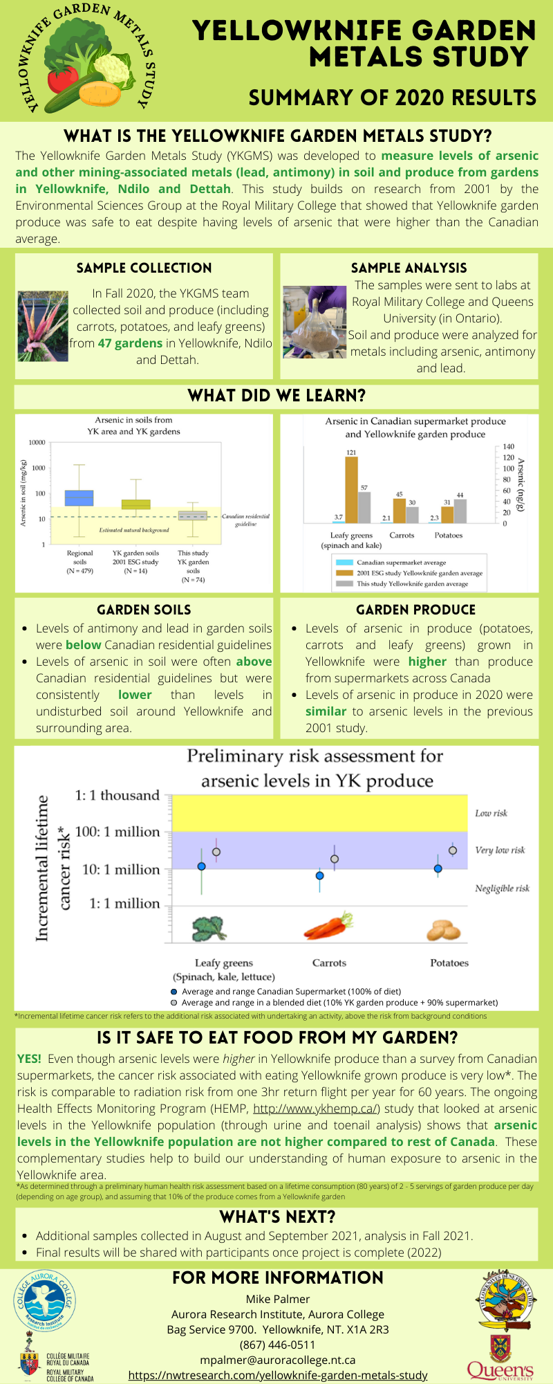
  • A 2001 study from Royal Military College found that produce from 9 Yellowknife gardens had higher levels of arsenic than the national average, a risk assessment concluded that the Yellowknife garden produce is still safe to eat.
  • A growing number of YK residents have personal gardens or are starting agricultural initiatives, including selling locally grown produce.  It is important to evaluate the levels of arsenic in garden soils and produce to evaluate the risk associated with eating locally produced produce.

Objectives:

  • Conduct a survey of arsenic and metal concentrations in Yellowknife area garden produce and garden soils
  • Data from this study will inform a risk assessment for the consumption of garden vegetables for residents
  • Investigate how specific garden produce take up metals from soil and the form of arsenic present in local produce

Location:
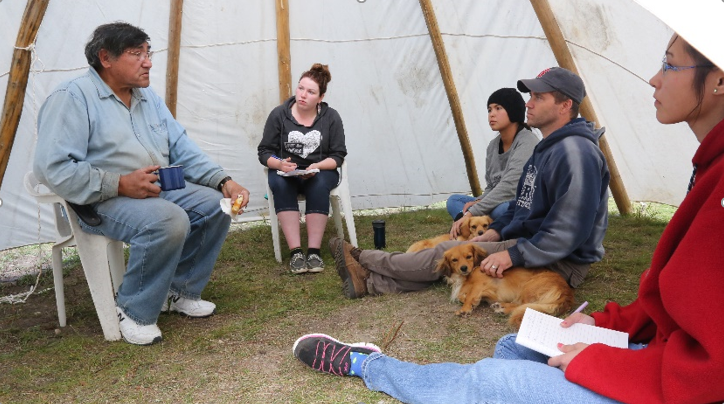
This study relies on participants from YK, Ndilo, Dettah and surrounding area submitting garden produce and soil for analysis. 

Methods:

  • Participants from Yellowknife, Ndilo, Dettah and surrounding area are able to submit garden produce and soil for analysis. 
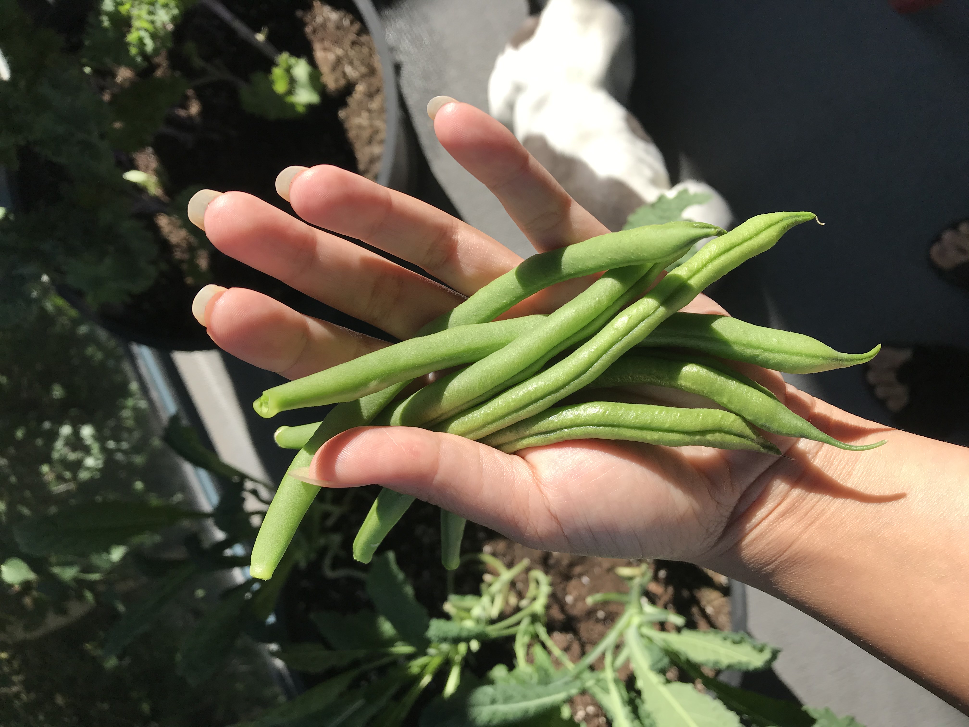
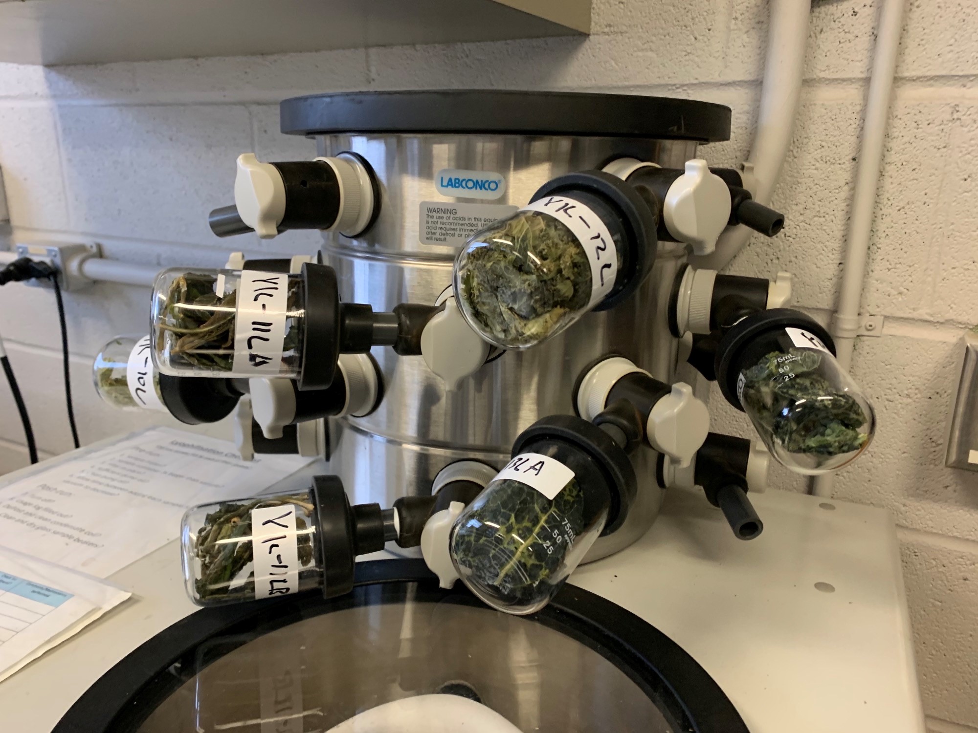
  • Any type of garden produce is welcome, we are particularly interested in spinach, kale, peas, beans, potatoes and carrots.
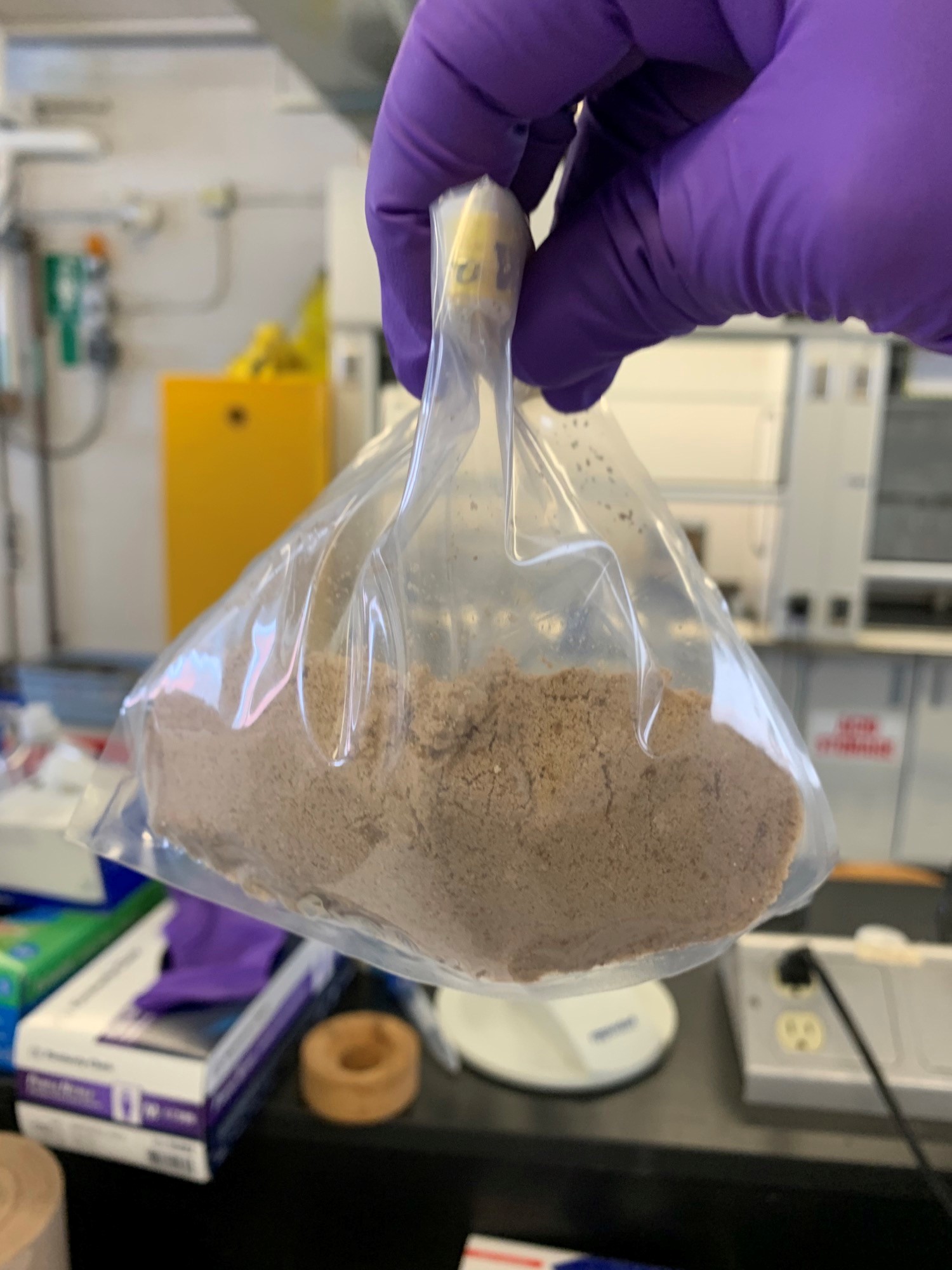
  • Participants are asked to harvest and wash garden produce as they would for consumption and place approximately 1 cup in a clean zip-lock bag.  Different types of produce should be place in different bags.  Collect approximately ¼ cup of soil from four different locations in your garden and place all the soil together in a separate Ziploc bag.  Label all the bags with the date of collection, location, and your contact information.  An accompanying sample collection sheet is available.
  • Produce and soil samples submitted will be sent to Queens University for analysis of arsenic and other mining associated metals
  • Participants who submit locally grown produce and soil to the study will receive their individual results and interpretation of what those numbers mean

Year 1 Summary:

Year 1 Summary PDF

Year 1 FAQ

External Partners:
Yellowknives Dene First Nation

Queens University

Royal Military College of Canada

Keywords:
Food, arsenic, metals, mining,

Category

Food & Agriculture


Updated September 2021

INNOVATE Centre for Arts, Crafts and Technology

INNOVATE Centre for Arts, Crafts and Technology

Main Project Contact:

Michael Olasode

Project Start Date:

2018

Project Name:

INNOVATE Centre for Arts, Crafts and Technology

Formerly: Arts, Crafts, & Technology Micro-manufacturing Centre (ACTMC)

Project Sites:

Find INNOVATE on the Canadian Foundation for Innovation Research Facilities Navigator HERE.

Overview:

The INNOVATE Centre for Arts, Crafts and Technology is located in Inuvik, Northwest Territories (NWT), and serves communities in the Inuvialuit Settlement Region (ISR) and the Gwich’in Settlement Area (GSA). At the INNOVATE Centre for Arts, Crafts and Technology our vision is to create an affordable, inclusive and supportive environment for people of all ages and to provide them with necessary equipment and skills to create opportunities, earn better livelihoods, and contribute to a stronger economic ecosystem.

Mission:

The INNOVATE Centre for Arts, Crafts and Technology's mission is to provide a well-equipped facility and empower individuals with tools and techniques to create innovative, unique products that enable them to generate a livelihood and bring about socio-economic development in the region.

Values:

As a flagship makerspace for providing a vital space where technology and traditional arts merge to create better opportunities, our values include:

  • Training and motivating local artists to get upskilled and become confident to start their businesses for improved livelihoods;
  • Supporting and encouraging local communities by inviting them to learn, express their creativity and contribute to social and economic wellness; and
  • Empowering local residents and inspiring innovative thinking through research and supporting Traditional Knowledge by using modern technology

Location:

The centre is located at 68 Veteran’s Way in Inuvik NT and serves the communities of the Beaufort Delta. To date, INNOVATE has delivered training and provided equipment access in Tuktoyaktuk, Fort McPherson, Tsiigehtchic and Ulukhaktok.

Methods:

INNOVATE has the following equipment available including training on all equipment and software:

  • Direct colour UV printing
  • CNC milling
  • Laser engraving
  • 3D printing
  • Vinyl cutting
  • Leatherworking
  • Complete carpentry shop
  • Silk screening
  • Adobe Illustrator
  • Computer lab with design software (Adobe Illustrator, V-Carve Pro, Computer-Aided Design (CAD) software)

INNOVATE offers workshops, training, and materials/methods research supports on all equipment in the centre.

Front Space

Laser Engraver

Sewing Station

Woodworking Shop

External Partners:

Gwich’in Tribal Council

Inuvialuit Regional Corporation 

Inuvialuit Community Economic Development Organization

Natural Sciences and Engineering Research Council 

Government of the Northwest Territories – Industry Tourism and Investment

Canadian Northern Economic Development Agency

Media:

Inuvik’s ACTMC rebrands as INNOVATE

Inuvik's micro-manufacturing centre creating items for essential workers during pandemic - CBC NEWS

Newsletters:

March/April 2022

February 2022

December 2021

November 2021

October 2021

September 2021

August 2021

Gallery (made by ACTMC members):  


We acknowledge the support of the Natural Sciences and Engineering Research Council of Canada (NSERC).

Updated 2025

Research Capacity and Support Here (CASH)

Research Capacity and Support Here (CASH)

Main Project Contact:

Jessica Dutton

Project Start Date:

October 2018

Project End Date:

June 2020

Project Name:

Research Capacity and Support Here (CASH)

ARI Team:

Jessica Dutton
Tanya Henderson
Allison Chandler

Overview:

Research Capacity and Support Here (CASH) is a grant-writing workshop focused on improving Northern researchers’ access to and success competing for federal research funding. Federal research granting agencies are expanding eligibility to hold research funds to new organizations, including Indigenous organizations in the Northwest Territories. This is an opportunity for NWT researchers and community organizations to undertake and lead research independently; however, to be competitive against applicants from southern universities, NWT researchers need equivalent support services to their southern counterparts. Canadian academic institutions have staff research officers who work with research funders to understand their programs, provide grant-writing training and development workshops for staff, and review proposals in-house before submission to funders.

In an effort to address this gap, the Aurora Research Institute has partnered with Hotii ts’eeda to provide a three-day workshop that features presentations and proposal workshopping sessions led by successful researchers and research officers who will share their expertise with participants. The participants will be made up of potential NWT researchers (including college staff), community researchers, Indigenous and local knowledge holders, and community partners who are often asked to partner on research.

Objectives:

  1. Guided development of participant understanding of how to write proposals and draft research proposals to produce a competitive proposal for SSHRC, CIHR, or NSERC;
  2. Development of a stronger network of independent academics, Indigenous knowledge holders, and researchers in the NWT and increased understanding of how to convene partnerships within their community to ensure necessary partnerships and support for successful research;
  3. A better understanding within ARI and Hotii ts’eeda about the types of research projects that researchers would like to undertake;
  4. A better understanding of the level of grant writing skills and abilities within the NWT, with a view to both developing and leveraging strengths in the service of securing research funding from tri-council, as a basis for refining development and delivery of grant writing workshops.

Location:

The workshop will be offered in Inuvik and participants will be invited from across the NWT. The project funding will cover travel for participants wishing to attend from other communities

Schedule:

The workshop is scheduled for May 5-7, 2020. The ARI team will develop resources based on the workshop content that will be made available to the public after the workshop.

External Partners:

Stephanie Irlbacher-Fox, Hotii ts’eeda 
Sara Komarinksy, Hotii ts’eeda
Rachel MacNeill, Hotii ts’eeda
Jullian MacLean, Hotii ts’eeda


Permafrost Information Hub

Permafrost Information Hub

Main Project Contact:

Joel McAlister

Project Start Date:

May 2019

Project End Date:

Ongoing

Project Name:

Permafrost Information Hub

ARI Team:

Jennifer Humphries

Joel McAlister

Edwin Amos

Ryan McLeod

Greg Elias

Celtie Ferguson

Kata Kuhnert 

Past Team Members:

Kathryn Barr

Overview:

Permafrost provides a foundation for northern ecosystems, infrastructure and communities. Permafrost conditions are inextricably linked to climate, so information on permafrost is now increasingly critical for environmental monitoring and research, assessing effects of climate change and for planning and managing resilient infrastructure and communities. The overall goal of the Permafrost Information Hub is to improve collaboration and information sharing between permafrost researchers and northern stakeholders, conduct northern relevant research projects, and increase capacity for permafrost research.

Alice Wilson Talon Drilling

Location:

The permafrost data consolidation is along Dempster- Inuvik Tuktoyaktuk Highway (ITH) corridor. Field work and research sites are located near the Dempster and ITH from the border to Tuktoyaktuk. Snow manipulation locations are paired with established permafrost monitoring sites located along the ITH. Currently working toward establishing monitoring sites with communities.

Methods:

  • To improve collaboration, knowledge transfer and communication we are working with local organizations to increase community-based permafrost research and monitoring. This includes working with the Inuvialuit Land Administration (ILA) environmental monitors in the creation of standard monitoring protocols and establishing sites near communities to be maintained by local community members. We continue conduct community presentations and discussions throughout the Mackenzie Delta region on ongoing projects.

  • To create a permafrost information hub we will create a set of long-term permafrost monitoring sites along the Dempster- ITH corridor that will be maintained and downloaded yearly. In collaboration with the Northwest Territories Geological Survey a standardized ground temperature reporting template was created and is being tested at current sites. Dempster-ITH ground temperature data sets will be compiled for input into the standardized ground temperature database. We are also working with local organizations in creating a observational permafrost template for collaborative monitoring between industry, government, and communities.

  • To design and test new tools for monitoring and mitigating we are testing out and providing feedback on different drilling systems, working with various ground temperature sensors, and exploring the use of UAV surveys. We are supplying in-kind service to support community-driven research at the Igloo Church to better mitigate and adapt to permafrost degradation.

  • To determine whether manipulating can preserve permafrost we have established 6 snow manipulation sites along the ITH. These locations are paired with established permafrost monitoring sites and have been instrumented with ground temperature sensors. Working with local industry snow compactions have now been completed for two winters.

Temperature Loggers

Schedule:

  • A permafrost monitoring workshop was held with ILA environmental monitors from Inuvik, Tuktoyaktuk, and Aklavik in September 2019 and a workshop with monitors from all of the ISR communities was held in January 2020 and March 2021 to discuss how to increase permafrost monitoring capacity. Presentations to the local hunter and trapper committees and renewable resource boards will be done yearly.

  • A new drilling system was purchased in the summer of 2019 and used to install ground sensors and will be tested for permafrost core extraction in summer 2021. Two forms of ground temperature loggers were installed in August and September 2019 and will be downloaded every year. Temperature loggers were installed in the Igloo church in August 2019 and will be downloaded every few months. Drilling was conducted under the church and temperature loggers installed in May 2021.  The church basement will continue be surveyed monthly to investigate heave and/or subsidence of the permafrost.

  • Ground temperature sensors were installed in the summer of 2019 at the snow manipulation sites. Vegetation surveys of the sites were done in August 2019 and will be repeated each year. Snow compactions were conducted in the winters of 2019/2020 and 2020/2021.

  • The Thermokarst Mapping Project will continue mapping and will create products for communities in the Western Arctic. Unmanned Aerial Vehicle flights will be conducted in summers to provide additional data on different thermokarst features.  

External Partners:

Alice Wilson, Northwest Territories Geological Survey

Steve Kokelj, Northwest Territories Geological Survey, Aurora College Research Associate

Ashley Rudy, Northwest Territories Geological Survey

Tim Ensom, Wilfrid Laurier University

Chris Burn, Carleton University, Aurora College Research Associate

Emma Stockton, Carleton University

Charles Klengenberg and Environmental Monitors, Inuvilauit Land Administration

Media: 

Scientists unlocking secrets of permafrost along ITH - INUVIK DRUM

Keywords:

Permafrost, Permafrost mapping, Permafrost thaw, Permafrost Degradation, Thermokarst, Monitoring, Environmental monitoring, Ground temperature, Periglacial processes, UAV


Support:

We acknowledge the support of the Natural Sciences and Engineering Research Council of Canada (NSERC)


Updated May 2021

A GIS to Support Community Monitoring of the Effects of Climate Change in Tuktoyaktuk

A GIS to Support Community Monitoring of the Effects of Climate Change in Tuktoyaktuk

Main Project Contact:
Garfield Giff

Project Start Date:
2019

Project End Date:
On-going

Project Name:
A GIS to Support Community Monitoring of the Effects of Climate Change in Tuktoyaktuk

ARI Team:
Celtie Ferguson
Garfield Giff

Overview:

The effects of climate-driven changes on the Hamlet of Tuktoyaktuk are evident in all aspects of the community’s life. To better understand these effects and to communicate it to the residents, the Tuktoyaktuk Community Corporation (TCC) decided to undertake the “Tuktoyaktuk Community Climate Resilience Project.” The aim of the project is to increase the awareness and knowledge of Tuktoyaktuk residents on the effects of climate-driven changes on their community. This will be achieved through the use of scientific methodologies, as well as the knowledge and wisdom of community Elders. Measuring and monitoring of the effects of climate change will be done by the community.

Aurora Research Institute (ARI) will support the TCC Resilience Project through capacity building and GIS services. ARI will assist the TCC in growing the community’s capacity to measure and monitor the effects of climate-driven changes, as well as develop GIS tools and services to efficiently collect, manage and disseminate the information.

Objectives:

The aim of the project is to assist the Hamlet of Tuktoyaktuk in developing their capacity to using geospatial tools and services to support the collection, management, and dissemination of climate change related data. To achieve this goal the following objectives will be pursued:

  1. Grow awareness of geospatial tools and services in the Hamlet of Tuktoyaktuk;
  2. Build capacity on geospatial tools;
  3. Grow the use of geospatial tools and services in measuring and monitoring the effects of climate change in the Hamlet of Tuktoyaktuk; and
  4. Support the Hamlet of Tuktoyaktuk in the collection, management and dissemination of climate change related information.


Location:
The project will be carried out within the Hamlet of Tuktoyaktuk. Key focus areas are:

  • 69.464189 -133.051985
  • 69.452513 -132.954412
  • 69.382699 -133.006441
  • 69.391822 -133.099662

Methods:

The project will utilize the following methodologies:

  • Project Management
  • GIS architecture and implementation;
  • Data collection using:
    • ArcGIS Survey 123;
    • Remotely Piloted Aircraft Systems; and
    • GPS Methodology
  • Spatial analysis using ArcMap;
  • Tutorial and Hands-on training in data collection and dissemination;
  • Tutorial and Hands-on training in GIS;
  • Tutorial and Hands-on training in StoryMap creation; and
  • Data dissemination using ArcGIS online

Schedule:

Q1 Q2 Q3 Q4
Year 2018 - 2019      


  • Community Engagement
  • Project Planning
  • Meta Data Development
  • Capacity Building
Year 2019 - 2020      
  • Capacity Building in data collection, GIS and StoryMap
  • Support the creation of  Data Models
  • Support data collection
  • Support data collection
  • GIS Capacity Building
  • Support creation of GIS Layers
  • Capacity Building on QA/QC of data
  • Support QA/QC of  data
  • GIS capacity Building
  • Capacity Building: StoryMaps and data presentation
Year 2020 - 2021      
  • Capacity Building Survey 123
  • Data collection survey 123
  • Support the dissemination of results through StoryMaps
  • Provide GIS support upon request
  • Capacity Building RPAS
  • Capacity Building RPAS
  • Provide GIS support upon request

External Partners:

Kendyce Cockney, Tuktoyaktuk Community Corporation
Inuvialuit Regional Corporation
ESRI Canada


updated May 2021

On-the-land STEM Camps for Students in the Western Arctic

On-the-land STEM Camps for Students in the Western Arctic

Effectively informing youths about the effects of climate-driven changes on their environment requires methodologies that visible identify these effects in a fun-filled, entertaining, interactive and informative manner. This strategy will be even more effective if the lessons are delivered by persons the children can relate to and in an environment that is familiar and comfortable to them. Based on the above premise the project deliver climate change information to Western Arctic students through on-the-land programs that infuses traditional knowledge with Earth and Space science.  In this program, students—accompanied by a team of local elders, research scientists, and teachers—will visit local sites where the effects of climate-driven changes are identifiable. During the visit students will observe and participate in the use of the infusion of traditional knowledge with Earth and Space science to identify, map and monitor the effects of climate-driven changes on their environment.

Main Project Contact:

Garfield Giff

Project Start Date:

2019

Project End Date:

2022

Project Name:

Growing Climate Change Awareness Amongst Western Arctic Students Through On-the-land STEM Camps

ARI Team:

Garfield Giff

Celtie Ferguson

Greg Elias

Edwin Amos

Kata Kuhnert 

Overview:

The way-of-life and culture of the Western Arctic communities are closely intertwined with the land. Therefore, any negative impact on the environment of the Western Arctic will affect the way-of-life and culture of the people. Growing climate change awareness amongst youth is a key step in supporting Western Arctic communities in developing and implementing climate change mitigation strategies.

Effectively informing youth on the effects of climate driven changes on their communities requires methodologies that visibley identify these effects in an interactive, informative, and fun-filled manner. This project includes an on-the-land programs that infuses Traditional Knowledge (TK) with Earth and Space Science (ESS) with the goal that youth will be engaged in:

  • The local effects of climate driven changes;
  • The use of ESS and TK in identifying these changes;
  • The Application of ESS and TK to mitigate against the effects of these changes.

Objectives:

The two main goals of the project are firstly, to provide students from Western Arctic communities with hands-on experience of the effects of climate change on their community and the application of ESS in identifying, monitoring, and mitigating against these effects. Secondly, to develop a set of tools which will be used for educating other youths on the effects of climate driven changes. This land-based learning opportunity will highlight the application of ESS and TK to climate change activities, as well as incorporate students’ findings and experiences into a set of interactive teaching tools.

Location:

The project will take place in the Beaufort-Delta Education Council School District of the Northwest Territories. See map below courtesy of the Beaufort-Delta Education Council.

Methods:

The on-the-land program will be developed using the following methodologies: curriculum development, geomatics data collection techniques, GIS methodologies, map and StoryMap making methodologies, video production techniques, Traditional Knowledge, project management, lesson planning, literature review on STEM and Traditional Knowledge integration, Climate change monitoring, interviews of Elders and community members on the impact of climate change on their community, and workshops.

The results of the project will be communicated through videos with supporting lessons, and interactive maps and StoryMaps all illustrating the use of on-the-land activities to grow the awareness of the effects of climate change on Western Arctic communities.

Schedule:

Q1 Q2 Q3 Q4
Year 2018 - 2019      
     
  • Project Planning
Year 2019 - 2020      
  • Project Management (PM)
  • Lesson plans Framework design
  • Data collection
  • PM
  • Interactive Web Maps and Story Maps Framework design
  • PM
  • Development of lesson plans
  • Identification of on On-the-land sites
  • PM
  • Engage professionals and Elders to participate in the program
  • Site reconnaissance and preliminary mapping of the effects of climate change
Year 2020 - 2021      
  • PM
  • Development of planned on-the-land activities
  • Video shoot planning and training
  • PM
  • Review of program with all participants
  • Revise program based on feedback
  • PM
  • Program delivery
  • Video production
  • PM
  • Create Web Maps and StoryMaps
  • Video editing
Year 2021 - 2022      
  • PM
  • Program delivery
  • Video production and editing
  • PM
  • Update Web Maps and StoryMaps
  • PM
  • Project workshop to demonstrate and discuss the use of the materials
  • Dissemination of program materials.
  • PM
  • Review of program with all participants and organizations that received the materials.
  • Up dating of materials
  • Project reporting

External Partners:

Alice Wilson, Northwest Territories Geological Survey 

Emma Stockton, Carleton University

American Geophysical Union: Centennial Program

Beaufort Delta Education Council

Keywords

On-the-land programs, climate Change; GIS, STEM; Traditional Knowledge; StoryMaps; interactive maps; lesson plans for on-the-land programs; earth and space science.


Updated May 2021


Stories of Hope

Stories of Hope

Main Project Contact:
Dave Porter

Project Start Date:
September 2016

Project Name:
Decolonizing Learning in Communities Across Canada: Stories of HOPE

ARI Team:
Sarah Rosolen

Overview:

Canada’s education system is failing its Indigenous students. Educational institutions need to confront the impacts of ongoing colonialism in their classrooms if they want to engage Indigenous students and close education gap that exists for them.  Approaching education through a decolonized lens may be a solution.  Decolonizing school systems involves rethinking the way schooling is delivered, including curriculum, methodologies, and relationships with communities. 

Objectives:
Aurora College and the Aurora Research Institute are working with researchers across the country to look at different approaches to decolonial education that are emerging.  The researchers will work together to synthesize findings and tackle some tough questions related to moving forward with decolonial education.  

This information will hopefully ultimately arm teachers, schools, academic institutions and communities with the knowledge they need to move forward with the broad-sweeping changes that are required.

Location:
This project is being led by Aurora College at two locations in the NWT, Fort Smith and Yellowknife, and by other project team members in Alberta, Saskatchewan, Ontario, and New Brunswick. Of particular interest are the educational curriculum practiced in these various locations.

Methods:
This project is a national project involving regional case studies from across the country, being led by Aurora College. Two case studies will take place in the NWT (one in Fort Smith led by Sarah Rosolen and one in Yellowknife led by Suzanne Stewart). Each of these will use a regional research advisory team, involving collaboration with local people in determining the direction of research and communication of results. Potential avenues for communicating results will be a project booklet, webinar, and documentary. Results will also be shared at the Northwest Territories Teachers Association.

External Partners:

Dave Porter, Aurora College
South Slave Research Centre, Aurora Research Institute
Dr. Ann Sherman, University of New Brunswick
Dr. Suzanne Stewart,  Ontario Institute for Studies in Education/University of Toronto
Dr. Chris Scribe, University of Saskatchewan
Dr. Jeff Baker, University of Saskatchewan
Dr. Diane Conrad, University of Alberta
GNWT Department of Education, Culture and Employment

Keywords:
Educational evaluation, decolonial education, education gap

Permafrost Monitoring Program

Permafrost Monitoring Program

Main Project Contact:
Erika Hille

Project Start Date:
January 2012

Project End Date:
Ongoing

Project Name:
Permafrost Monitoring in the Inuvik Region

ARI Team:

Edwin Amos

Greg Elias

Ryan McLeod

Overview:
Recent climate warming has led to increases in surface air and ground temperatures, which has contributed to regional permafrost degradation, or permafrost thaw, across the Beaufort Delta Region. Thawing permafrost has led to infrastructure challenges across the region; roads and waterways are experiencing slumping along their borders, and buildings built on pilings are starting to tilt.  For many years, Dr. Burn has studied changes in permafrost stability and ground temperature at various locations in the western Arctic, with a focus on the outer Mackenzie delta. He has an array of thermistor installations, ranging from Herschel Island, on the Yukon North Slope, to Paulatuk, on the Arctic Ocean coast of the NWT.  At each site, ground temperature sensors are deployed in steel pipes, inserted into the ground through the permafrost layers.  Ground temperature readings are measured and recorded to develop temperature profiles and observe changes in temperature/depth across these profiles over time. 


Objectives:
The main objective of this monitoring program is to improve our understanding of how climate change is affecting permafrost in the western Arctic.  The ice content of permafrost terrain affects its stability, and as ice melts this can result in damage to infrastructure and changes to the landscape. Permafrost monitoring is a crucial step in preparing for these changes.

Permafrost Monitoring     

Location:
The field team visits two sites near the town of Inuvik.  One site is located off the Dempster Highway, just past the Inuvik airport, and the other site is at NRC Lake, located next to Big Lake Channel in the Mackenzie River Delta.

Permafrost Monitoring  

 Methods:
The field team visits both study sites once a month. At each site, the team takes ground temperature readings from a thermistor string buried in the permafrost. Measurements of local snow depths (in winter) and active layer depths (in summer) are also recorded.

Schedule:
Sampling occurs monthly throughout the year.

External Partners:
Dr. Chris Burn, Carleton University

Keywords:
Permafrost, active layer, talik, snow depth, active layer depth, thermistor


Updated May 2021

Mapping and Monitoring Earth Movement Along the Caribou Hills, Inuvik, NWT

Mapping and Monitoring Earth Movement Along the Caribou Hills, Inuvik, NWT

Main Project Contact:
Garfield Giff

Project Start Date:
March 2018

Project End Date:
March 2020

Project Name:

Using Remotely Piloted Aircraft Systems (RPAS) Technology to Map and Monitor Earth Movement Along the Caribou Hills, Inuvik, NWT

ARI Team:
Greg Elias
Garfield Giff
Celtie Ferguson
Edwin Amos

Katarina Kuhnert 

Past Team Members: 

Eric Cheyne

Overview:

Climate driven changes are affecting the landscape and the way of life of the people of the Northwest Territories (NWT). These effects on the landscape are visible along the coastlines, inland to the valleys, water channels, and along the slopes. To mitigate against these changes and to protect infrastructure, people, and wildlife it is important that the necessary tools are available to support the development and implementation of climate change adaptation measures. This project aims to develop and make available one such tool in the form of online hazard maps.

The maps will cover the Caribou Hills, in particular the section within the vicinity of Reindeer Station. This is an area of concern to the community due to the frequency in landslides and slumps. The NWT Geological Survey reported 80 landslide events in September 2017 along a 20km stretch of the Caribou Hills. The previous recorded high was 25 landslides in October 2009.


Objectives:

The main objective of the project is to develop and disseminate hazard maps and additional information (spatial and non-spatial) to support the development and implementation of climate change adaptation strategies for the Caribou Hills. This information will be available to inform: regulations, vulnerability assessments, infrastructure activities, transportation, hunting and trapping, fishing, and other recreational and wellness activities along the Caribou Hills, as well as support the NWT Geological Survey planned geohazard mapping and geohazard risk assessment surveys. For example, the IRC could use the information to support more informed decision making on future planning for the cabins at Reindeer Station.

Location:
The research area spans a 2.5 km stretch of the Caribou Hills (68.67°, -134.12°; 68.69°, -134.14°) which rolls along the East Channel of the Mackenzie River between Inuvik to the south and Tuktoyaktuk to the north. A key focal point of the research site is Reindeer Station (Latitude 68.69° and Longitude -134.14°) a NWT historic landmark and an Inuvialuit wellness and cultural camp.

Methods:

The project team will utilize a number of different methodologies in the pursuant of the objectives. This will include but not limited to the following:

  • Community Engagement and Project Planning;
  • Project Planning and Project management;
  • Data and Literature Review;
  • Data Collection;
  • GIS Development (architecture and implementation);
  • Data analysis;
  • Simulation Modelling;
  • Information Dissemination

The results of the project will be communicated and disseminated using the following:

  • Scientific publications;
  • Plain language reports;
  • Maps and charts;
  • StoryMaps;
  • Workshops;
  • Oral and poster presentations; and
  • Through the IRC’s Portal.

Schedule:

Q1 Q2 Q3 Q4
Year 2017 - 2018    


  • Community Engagement
  • Community Engagement
  • Project Planning
Year 2018 - 2019      
  • Project Management
  • Data Review and Collection
  • PM
  • Data Collection
  • GIS Development
  • PM
  • Data Collection
  • GIS Development
  • PM
  • GIS Development
  • Community Engagement
Year 2019 - 2020      
  • PM
  • Data Collection
  • GIS Development
  • PM
  • Data Collection
  • GIS Development
  • PM
  • Data Management
  • GIS Prototyping
  • PM
  • Data Analyst
  • Community Engagement
Year 2020 - 2021      
  • PM
  • Data Analyst
  • Data Management
  • PM
  • Data Collection
  • Data Management
  • Data Analysis
  • PM
  • Data Management
  • Data Analysis
  • Simulation Modeling
  • PM
  • Data Analysis
  • Simulation Modeling
  • Community Engagement
  • Data Dissemination
Year 2021 - 2022      
  • PM
  • Data Analysis
  • Data Management
  • Map Production
  • PM
  • Data Management
  • Data Analysis
  • Simulation Modeling
  • PM
  • Data Management
  • Simulation Modeling
  • Publications
  • Prototyping of Online Access to Project Information
  • PM
  • Community Engagement
  • Update prototype
  • Project Results Live Online
  • Publications

External Partners:
Inuvialuit Regional Corporation
Inuvik Hunters and Trappers
NWT Centre for Geomatics
NWT Geological Survey

Climate Change Preparedness in the North

Keywords:
Hazard mapping, Drone survey, GIS, Remote sensing, Landslides, Slumps, Climate change


updated May 2021


Western Artic Minerals Strategies GIS

Western Artic Minerals Strategies GIS

Main Project Contact:
Garfield Giff

Project Start Date:
March 2018

Project End Date:
March 2021

Project Name:
A Geographic Information System (GIS) to Support the Development and Implementation of Mineral Strategies in the Western Arctic

ARI Team:
Garfield Giff
Celtie Ferguson

Overview:

The GIS for Supporting Mineral Strategies in the Western Arctic (MSGIS) is an interactive online tool designed to bring together meaningful, current, and accurate data in order to support well planned, eco and community friendly investment in mineral exploration.

The tool is designed to allow anyone to explore the geology of an area while also examining the intersecting land use zoning data, environmental data, and oil, gas and mineral data. This includes special use areas, conservation areas, existing oil, gas, and mining leases, and species at risk ranges - among other datasets.

Objectives:

The aim of the project was to design and implement a GIS for the Western Arctic communities that integrates geoscience data with Western Arctic specific spatial and non-spatial data to visualize, analyze, identify, store, format, and present critical information to support the management of mineral strategies.

This project, the GIS for Supporting Mineral Strategy Development (MSGIS), aims to provide the decision-makers of communities with vital independent information to support decision making concerning the development, implementation, and maintenance of mineral strategies.

Location:

The GIS to Support the Development and Implementation of Mineral Strategies in the Western Arctic focuses on the Western Arctic, the region of the Northwest Territories north of 64° N. This includes the entire Gwich’in Settlement Area and Inuvialuit Settlement Region.

Methods:

The MSGIS commenced with consultations as to what would be relevant datasets one would include in decision making regarding mineral strategies. These datasets (such as land use plans, community conservation plans, and ecology) were then sourced and brought into the MSGIS, alongside new and updated geoscience datasets published through NRCan’s GEM program.

The MSGIS web page, web mapping application, and user guide were then built and made publically accessible online. https://msgis-nwt.maps.arcgis.com/

The following methodologies were used:

  • Stakeholder engagement;
  • Project management;
  • Data and Literature Review;
  • Data Collection;
  • GIS Development (architecture and implementation);

ARI will continue to provide access and training for the MSGIS project.


Schedule:

Q1 Q2 Q3 Q4
Year 2018 - 2019      


  • Project research and Planning
  • Stakeholder engagement
Year 2019 - 2020      
  • Project Management (PM)
  • GIS Training
  •  Data and Literature Review
  • PM
  • Data collection
  • Data management
  • Literature Review
  • GIS Development
  • PM
  • Data management
  • GIS Prototyping
  • GIS reviewed by stakeholder groups
  • PM
  • Poster presentation at ArcticNet 
  • Data management and visualization
Year 2020 -2021      
  • PM
  • Development of MSGIS web mapping applications and webpage
  • Data management and visualization
  • PM
  • QA/QC
  • Testing of online applications
  • PM
  • Public presentation and demonstration of MSGIS online tools
  • Follow up with interested organizations
  • MSGIS live to the public
  • MSGIS Training for the public

On November 16, 2020 the MSGIS tool was made publicly available.  On November 19, 2020 ARI staff held a webinar giving stakeholders and the pubic a chance to have a demonstration and view application of the MSGIS tool. 

View the recording here.

View the MSGIS tool here

Media:

Aurora Research Institute’s new Geographical Information System lets planners overlap mineral, biological and government data online - INUVIK DRUM

External Partners:
NWT Centre for Geomatics
NWT Geological Survey
Department of Industry, Tourism, and Investment; Petroleum Resources Division

Geo-mapping for Energy and Minerals

Keywords:
Western Arctic, Mineral Strategy, GIS to Support Mineral Strategy, Integration of GIS and Geoscience Data


Updated May 2021