Applied Energy Research Programs

Applied Energy Research Programs

Project Name:

Applied Energy Research Programs

ARI Team:

Dr. David Schwarz

Overview:

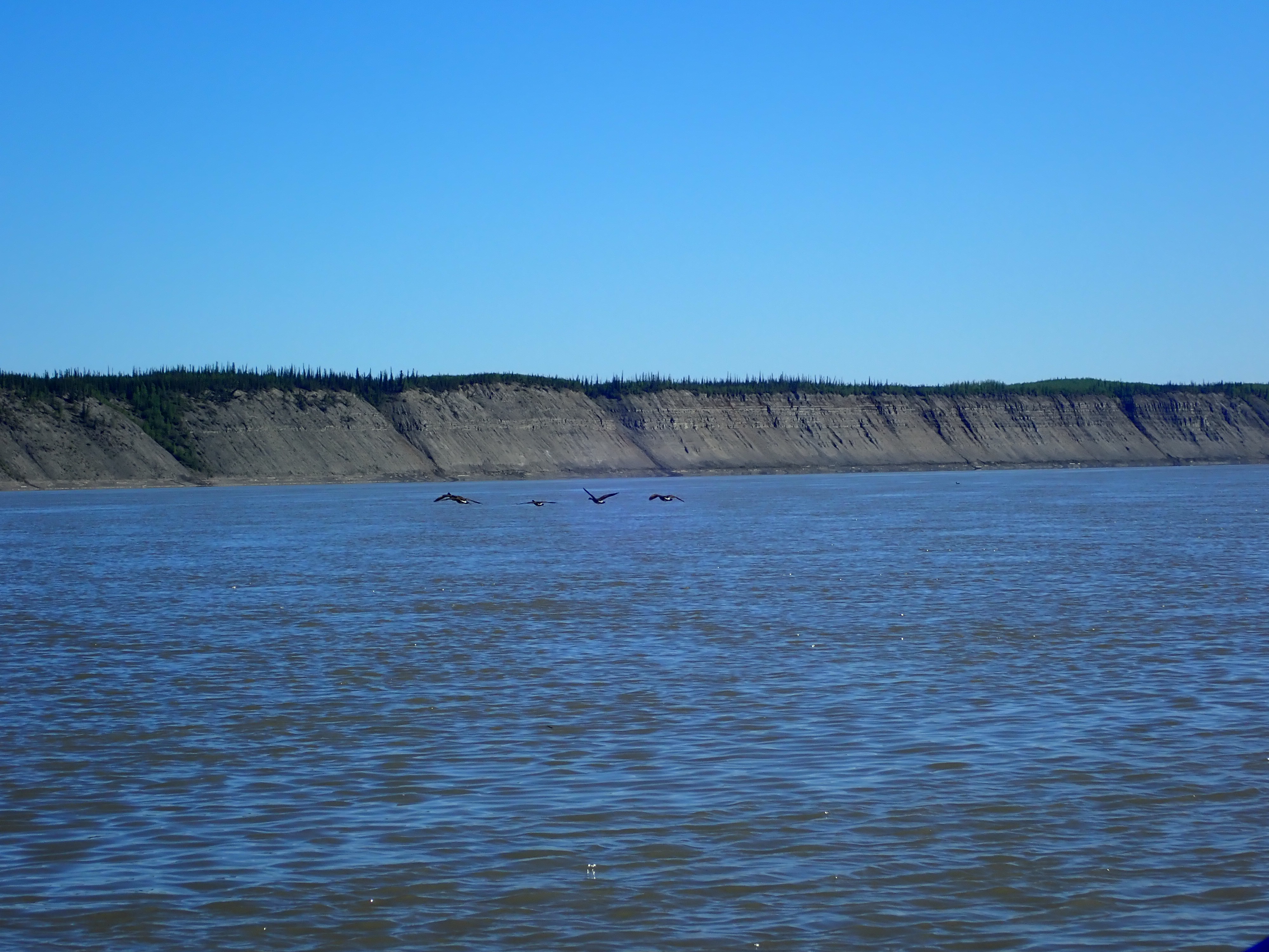
ARI has been at the forefront of renewable energy research in the Northwest Territories, conducting numerous wind and solar resource assessments over the last two decades.

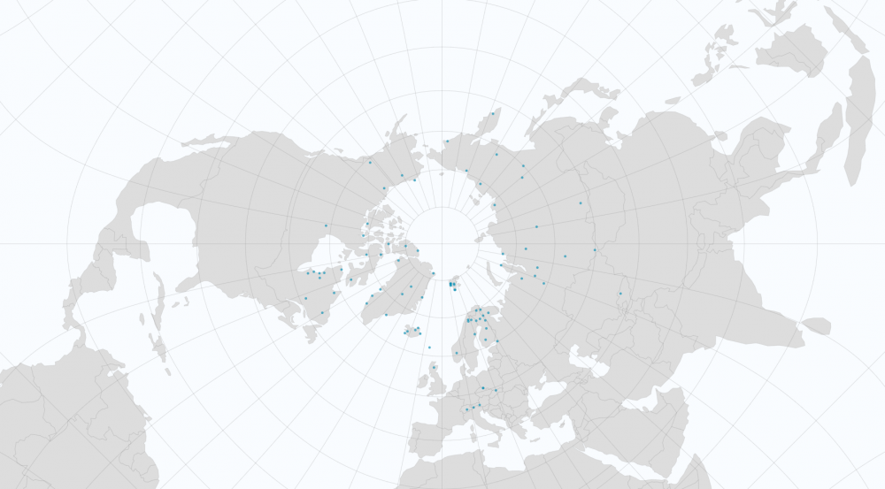
ARI has worked with multiple partners, including the Government of Canada and the Government of the Northwest Territories (GNWT) to perform wind and solar resource assessment monitoring campaigns for communities across the NWT. These campaigns produce data that is analysed to provide communities with assessments of their local wind and solar resources in order to make informed decisions concerning the feasibility of renewable energy investments.

 Objectives:

ARI’s Applied Energy Research Programs have the following objectives:

  • Build capacity within the NWT for the measurement and analysis of wind and solar data.
  • Provide decision makers with the latest wind and solar data from their communities.
  • Conduct wind and solar resource assessments for communities to inform renewable energy investments.

Locations:

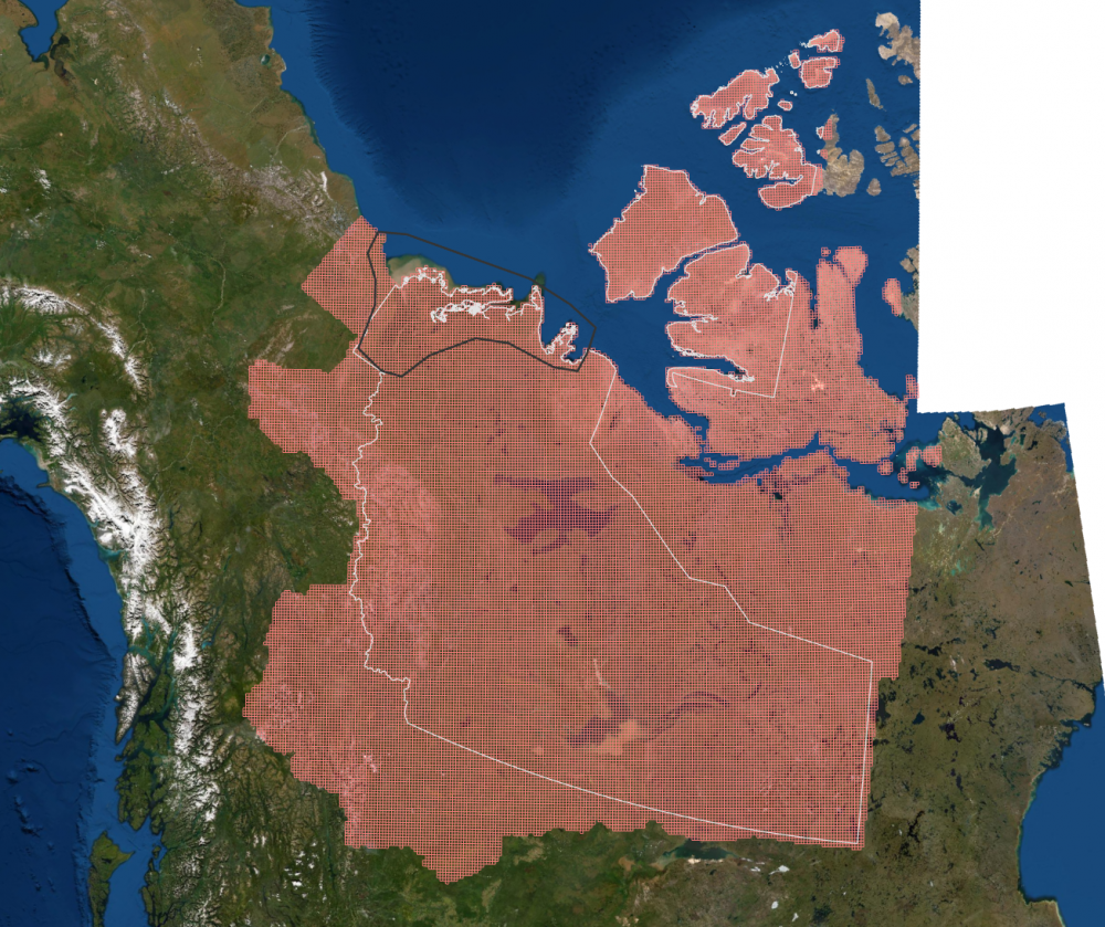
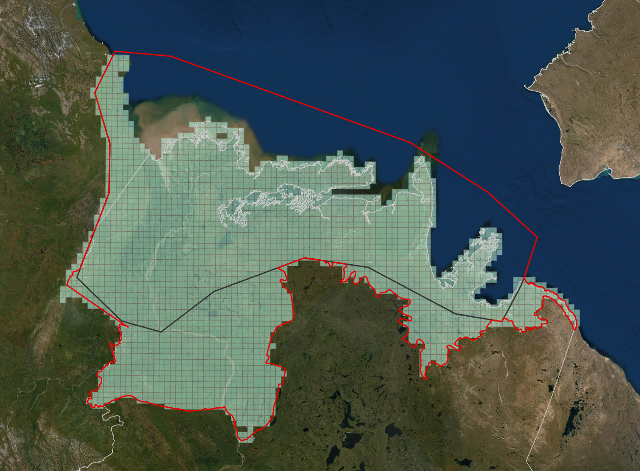
Wind and solar resource assessments have been performed for many communities across the NWT. If you are interested in any of the reports from communities visited in the past, please see the links at the bottom of this page.

Methods:

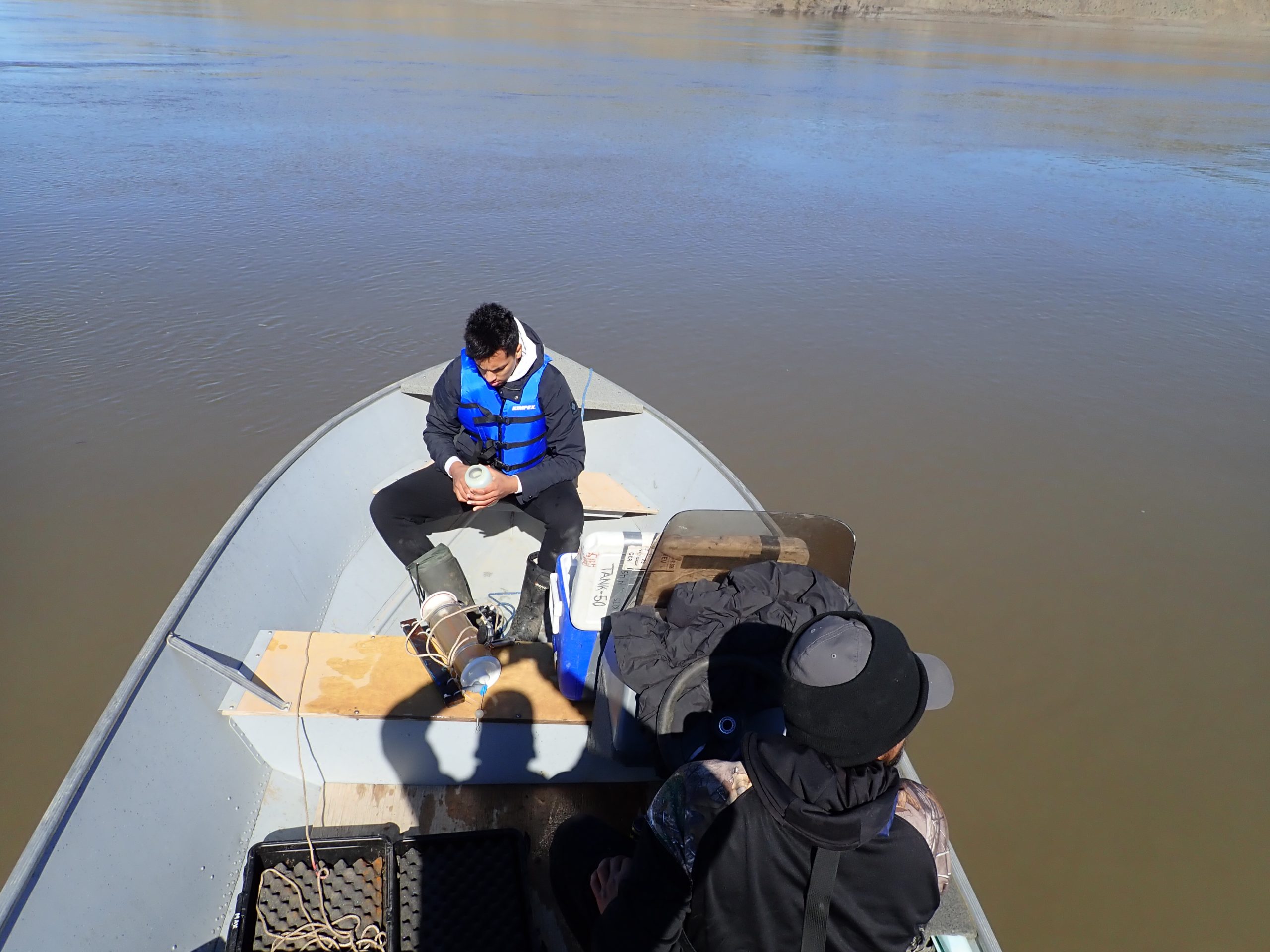
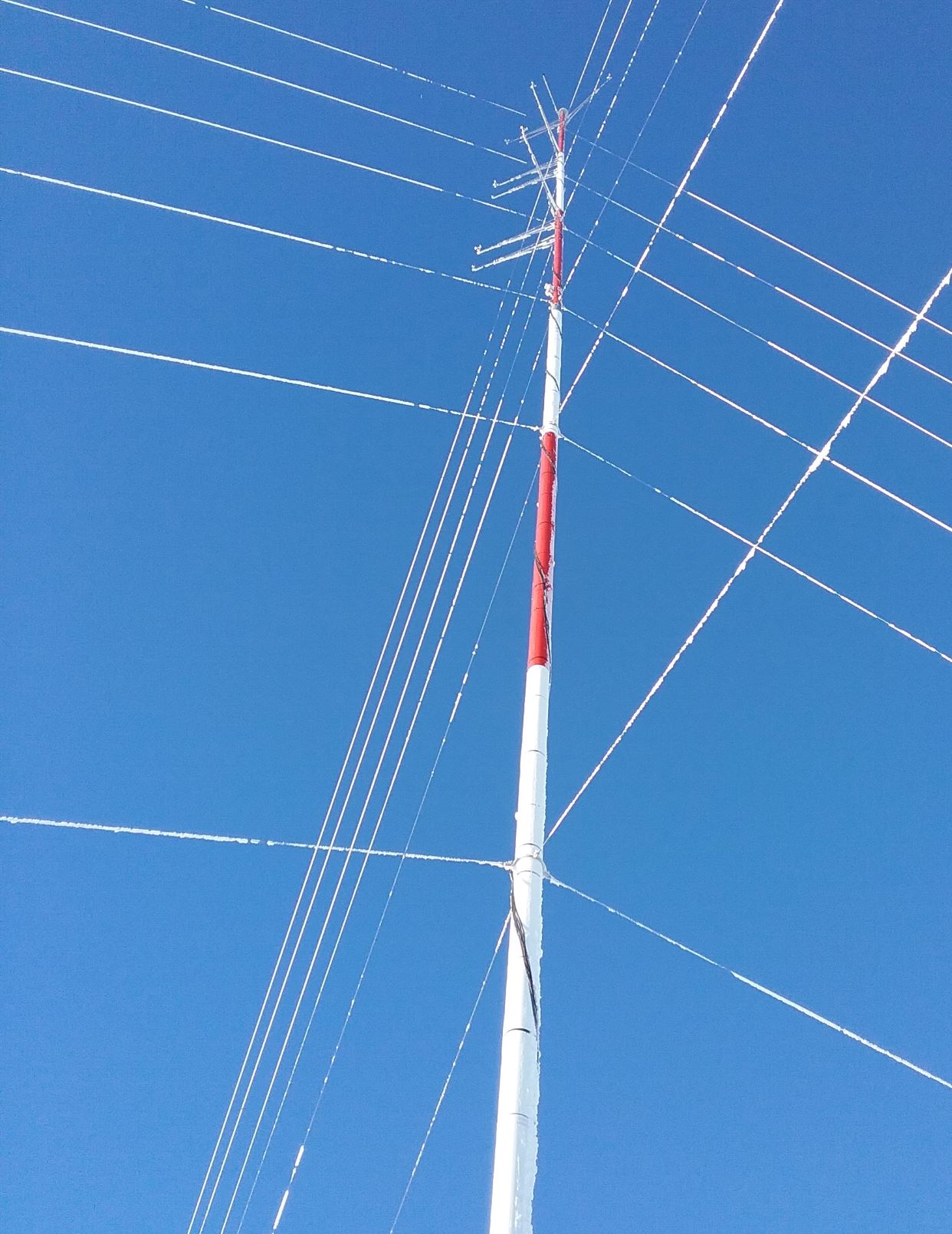
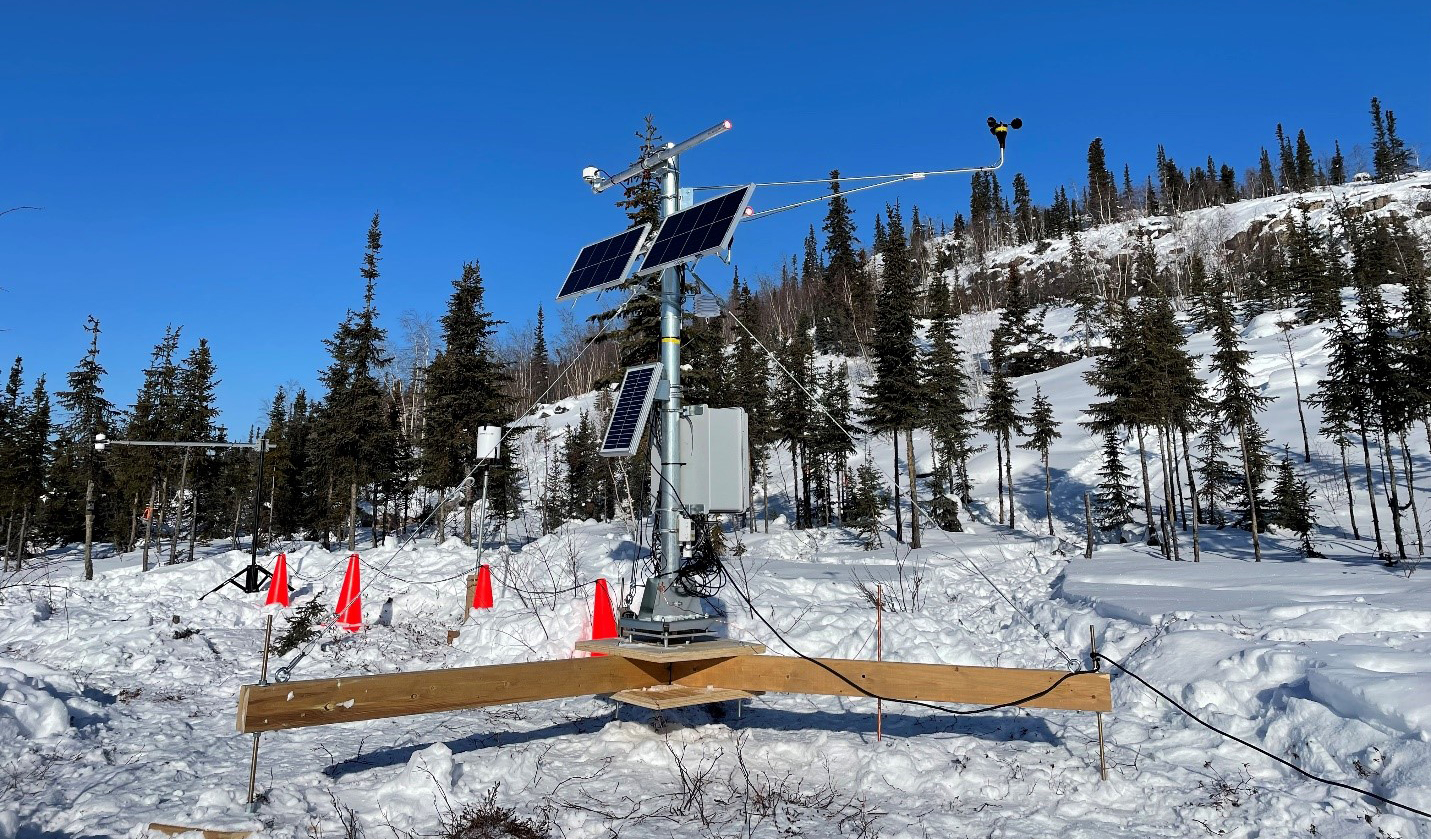
Historically ARI used meteorological towers with anemometers for measuring wind speeds and wind vanes for measuring wind directions, installed at different heights to get an understanding of how wind changes with height.

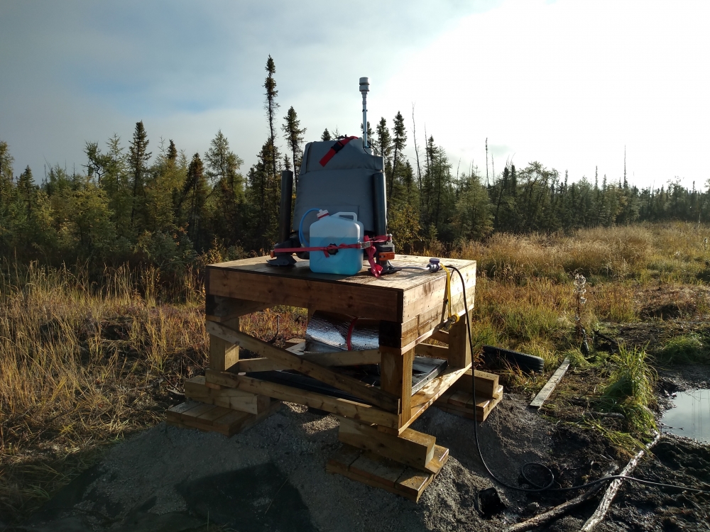
Developments in wind lidar (light detection and ranging) technology, which uses laser beams to measure wind speed and direction by detecting atmospheric particles, mean that similar measurements obtained from a meteorological tower can now be collected using wind lidars. These units have the advantages of being much smaller and simpler to transport, as well as requiring less ground disturbance to install compared to meteorological towers.

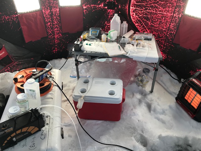
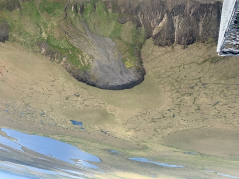
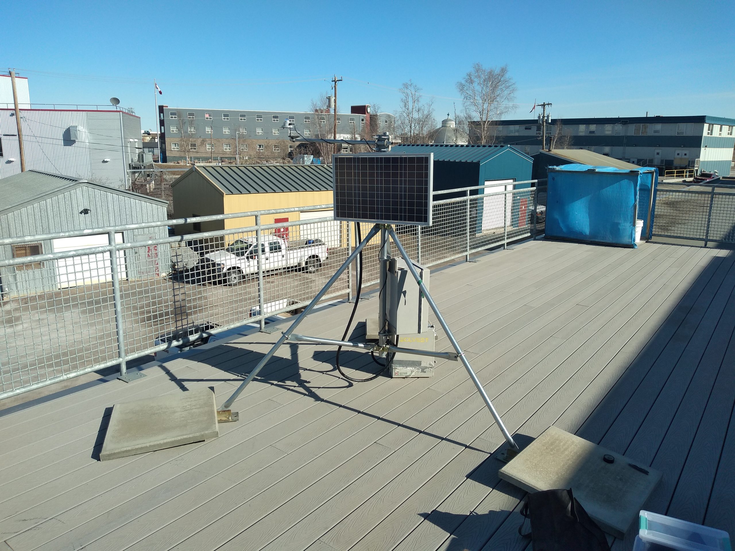
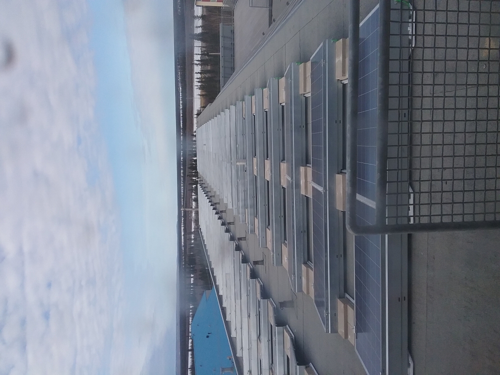
ARI has also been pioneering the use of solar resource assessment monitoring equipment, testing and demonstrating the effectiveness of deploying solar sensors in the NWT's extreme environments. Solar sensors measure the power of the sun as it hits a horizontal surface inside the sensor. They can also be placed upside down to measure the amount of solar radiation that reflects off the ground, which is very important for understanding how well bifacial solar photovoltaic (PV) panels might perform in a certain area. For northern climates, where snow in the winter, and dust in the summer can impact the performance of a solar installation, it is also possible to measure the soiling factor on PV panels. This provides an idea of how snow covered, or dirty a certain solar installation may be, which can then be used to predict maintenance needs in the future.

Monitoring Campaign Planning:

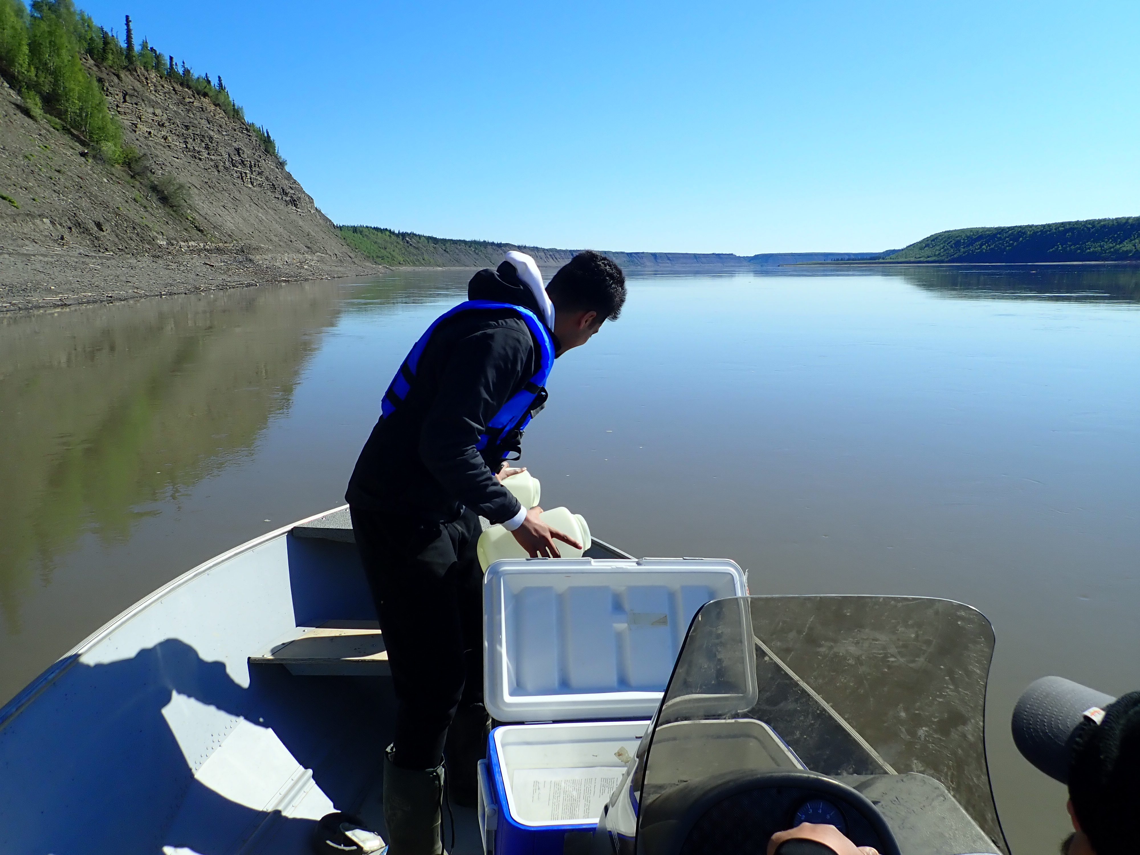
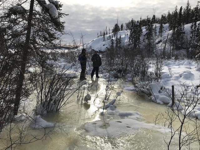
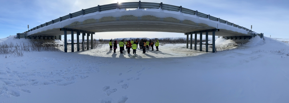
ARI works with community stakeholders that are interested in renewable energy to provide wind and solar resource assessments for their communities. Please reach out to the contact provided above if you are interesting in pursuing renewable energy for your community. After initial stakeholder engagements and at the request of the community, sites for wind and solar resource monitoring are identified with the community and then wind and solar resource monitoring equipment installed. During the monitoring campaign, the equipment requires regular maintenance that is commonly performed by local community members.

Schedule:

Wind and solar resource monitoring campaigns are typically two years or longer in duration. Over this time, researchers get an understanding of the changes in the wind and solar energy that happen daily and from season to season, as well as whether there are changes from year to year that need to be taken into account.

The resulting wind and solar data are analysed and incorporated into assessments of the feasibility of wind and solar energy investments. Results, recommendations and technical support are then provided to the communities to inform decisions concerning wind and solar energy investments.

Current Deployments:

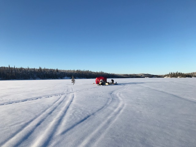
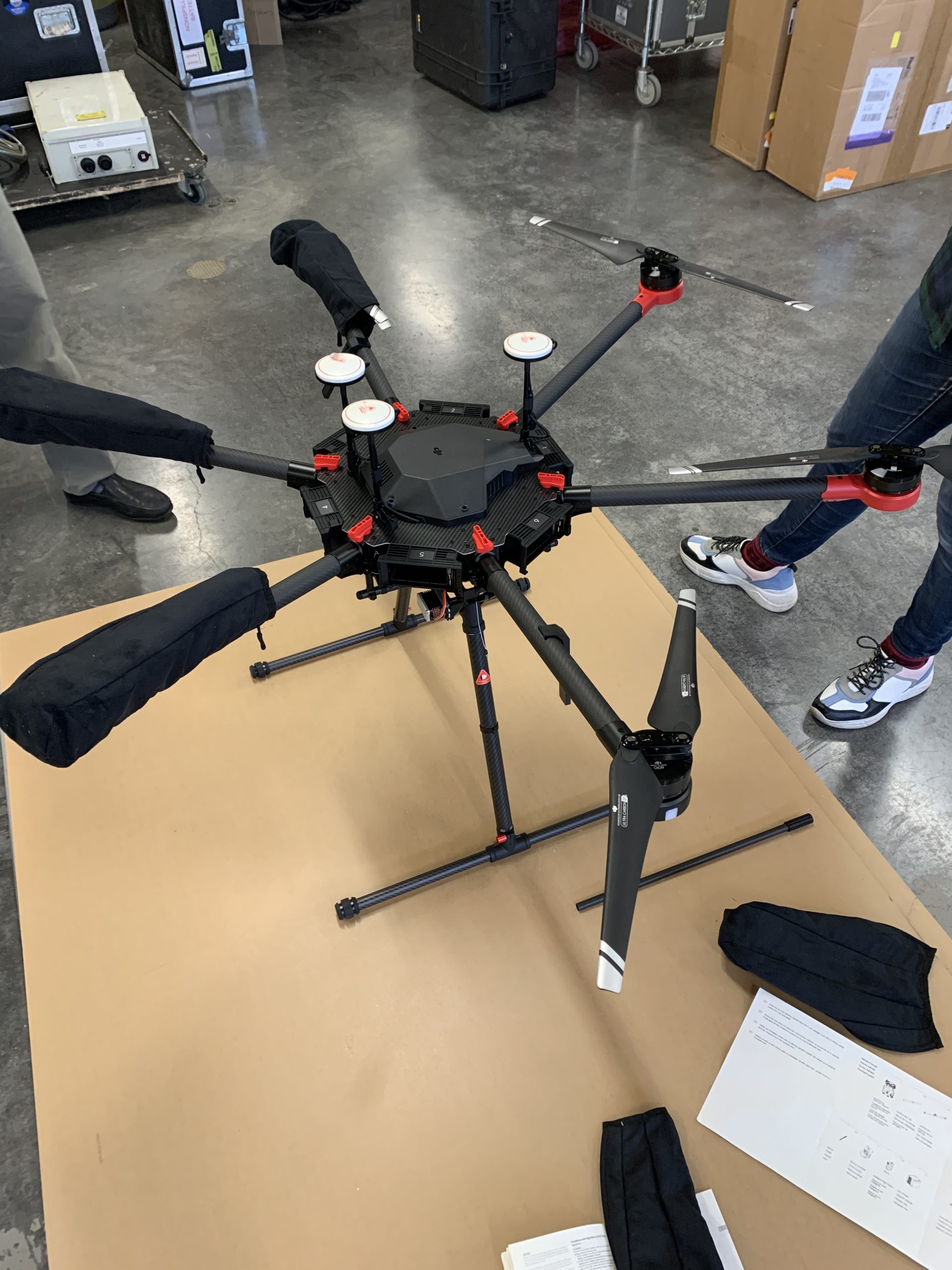
With financial support from the Government of Canada and the GNWT, ARI has acquired four ZX 300 Wind Lidar units for precise wind data collection, and three solar resource assessment (SRA) Systems to monitor solar resources. These systems are actively being used in four resource assessment monitoring campaigns across the NWT. The campaigns are collaborative efforts with community and industry partners, aimed at monitoring and characterizing the wind and solar resources of the communities involved.

  • Inuvik Solar Resource Assessment: Partnering with the Government of Canada's Inuvik Satellite Station Facility, this campaign validates solar array efficiencies using SRA System data.
  • Fort McPherson and Tsiigehtchic Wind Resource Assessment: In collaboration with NTPC, ZX 300 Wind Lidars collect wind data from sites at the local power plants. 
  • Wekweètì Wind and Solar Resource Assessment: A joint initiative with the Tłı̨chǫ Community Government and ATCO, combining ZX 300 Wind Lidar and SRA System data collection. 
  • Paulatuk Wind and Solar Resource Assessment: Teaming up with the Hamlet of Paulatuk, the local Energy Working Group and ATCO, this campaign gathers comprehensive wind and solar data. 


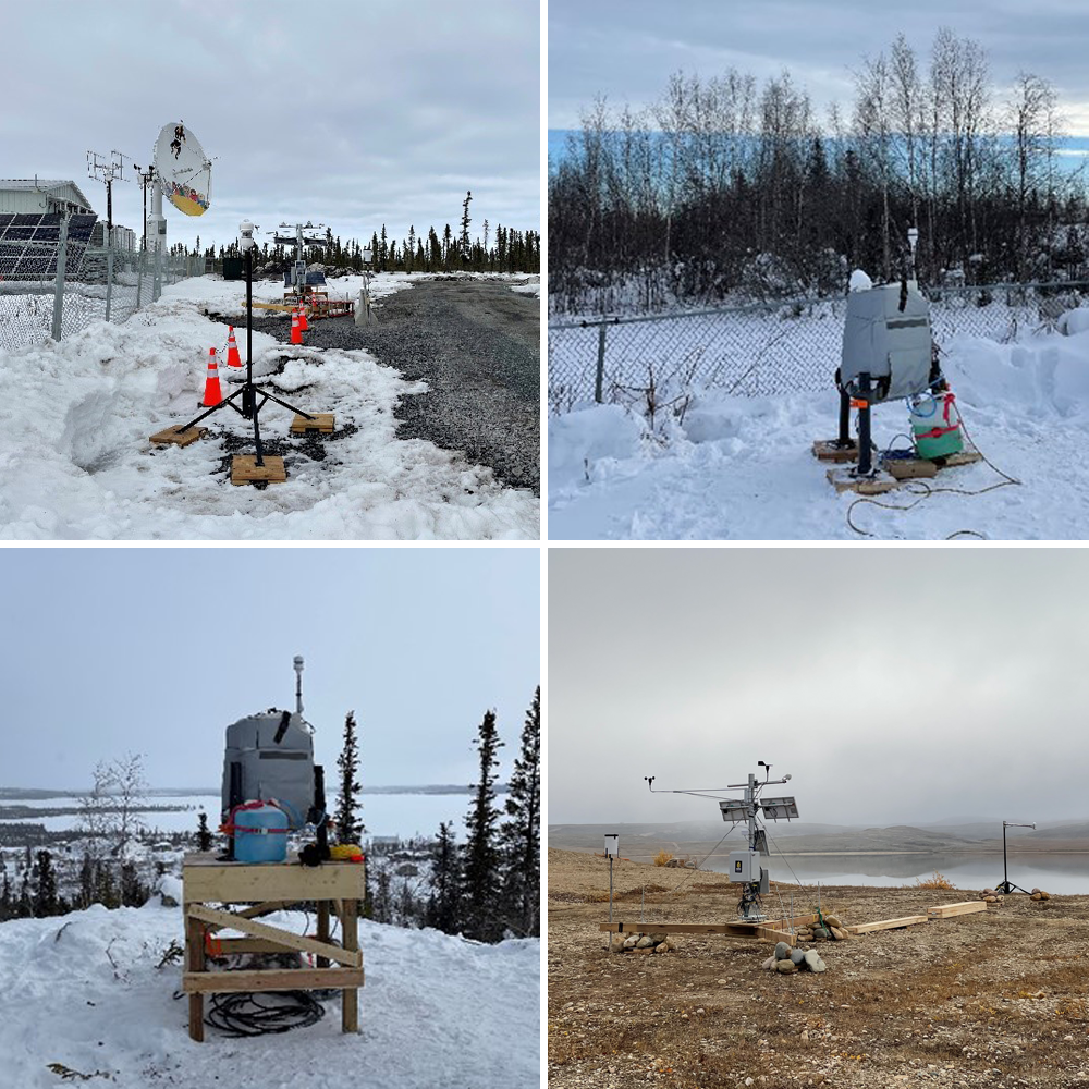
 SRA System at Inuvik Satellite Station Facility (top left), ZX 300 Wind Lidars in Fort McPherson (top right) and Wekweètì (bottom left), and SRA System in Paulatuk (bottom right)

This information will ultimately allow for the estimation of wind turbine and solar PV panel annual energy output, influencing design choices for wind and solar installations. The gathered data will be shared with the communities to support future wind and solar energy investments. Additionally, ARI will disseminate the findings to the public through detailed reports like those for previous campaigns below.

REPORTS: 

Regional

Wind Energy Monitoring in Six Communities in the NWT
State of the Art and Economic Viability of Wind Power Development in Arctic Communities
Inuvialuit Region Wind Energy Pre-feasibility Study

Colville Lake

Colville Lake Wind Energy Pre-feasibility Study

Deline

Deline Wind & Solar Energy Pre‐feasibility Analysis Summary
Deline Wind & Solar Energy Pre‐feasibility Analysis

Fort Providence

Fort Providence Solar and Wind Summary
Fort Providence Solar and Wind Monitoring Analysis

Fort Liard

Fort Liard Wind Site Potential

Inuvik

Inuvik Wind Monitoring Update 2016
Inuvik Wind Summary Report: 2015
Inuvik Wind Energy Pre-Feasibility Analysis: 2015
Inuvik Wind Energy Assessment at Storm Hills (2014)
Inuvik Wind Energy Pre‐Feasibility Analysis Summary
Inuvik Wind Energy Pre‐Feasibility Analysis

Jean Marie River

Jean Marie River Solar and Wind Summary
Jean Marie River Solar and Wind Monitoring Update
Jean Marie River Wind & Solar Energy Pre‐feasibility Analysis Summary
Jean Marie River Wind & Solar Energy Pre‐feasibility Analysis

Lutselk'e

Lutselk'e Wind Energy Pre-feasibility Analysis Summary
Lutselk'e Wind Energy Pre-feasibility Analysis

Norman Wells

Norman Wells Wind Energy Pre-feasibility Analysis Summary
Norman Wells Wind Energy Pre-feasibility Study

Paulatuk

2009 Wind Energy Summary Report - Paulatuk
Paulatuk Wind Energy Pre-Feasibility Study

Sachs Harbour

2009 Wind Energy Summary Report - Sachs Harbour
Sachs Harbour Wind Energy Pre-Feasibility Study

Thor Lake

Progress Report for Thor Lake Wind Monitoring – November, 2010
Progress Report for Thor Lake Wind Monitoring – March, 2010
Wind Study for Thor Lake Area - 2009

Trout Lake

Trout Lake Wind & Solar Energy Pre‐feasibility Analysis Summary
Trout Lake Wind & Solar Energy Pre‐feasibility Analysis

Tuktoyaktuk

2009 Wind Energy Summary Report - Tuktoyaktuk
Wind Monitoring Update for Tuktoyaktuk - Winter 2009
Technical Aspects of a Wind Project for Tuktoyaktuk

Ulukhaktok

2009 Wind Energy Summary Report - Ulukhaktok
Ulukhaktok Wind Energy Pre-Feasibility Study

Wekweeti

Wekweeti Wind Energy Pre‐Feasibility Analysis Summary
Wekweeti Wind Energy Pre‐Feasibility Analysis

Whati

Whati Wind & Solar Energy Pre‐feasibility Analysis Summary
Whati Wind & Solar Energy Pre‐feasibility Analysis

Yellowknife

Yellowknife Area Wind Potential
Snare Wind Monitoring Update 2016
Potential Wind Farm Locations for the Yellowknife Area
Yellowknife Wind Energy Pre-feasibility Study 


Keywords

Wind, Solar Irradiance, Meteorological Tower, Wind Lidar, Solar Monitoring, Wind Resource Assessment, Solar Resource Assessment, Wind Energy, Solar Energy, Renewable Energy


Updated May 2025

Arctic Great Rivers Observatory (Arctic GRO)

Arctic Great Rivers Observatory (Arctic GRO)

Project Title:

Arctic Great Rivers Observatory (Arctic GRO)

Project Lead:

Edwin Amos

ARI Team:

Ryan Mcleod

Greg Elias

Overview:

Led by Max Holmes (Woods Hole Research Centre), Arctic GRO is a coordinated, international effort to collect and analyze a time-series of water quality and river discharge information from the six largest arctic rivers using identical sampling and analytical protocols. This includes the Ob, Yenisey, Lena, Kolyma, Yukon, and Mackenzie.

Objectives: 

The goal of this project is to examine long term changes in the seasonal biogeochemistry and discharge of the six largest Arctic Rivers, providing insight into the effects of climate and landscape change on the contributing catchment.

Location: 

The Western Arctic Research Centre leads the Mackenzie River team. Sampling occurs at Arctic Red (near Tsiigehtchic, NT).

Methods:

Water samples are collected from Arctic Red every two months. Samples are filtered and stored at the Western Arctic Research Centre until they can be shipped out for analysis.

Schedule:

Beginning in February 2017, sampling has occurred every two months.

External Partners:

Max Holmes (Project Director; Woods Hole Oceanographic Institute)

Jim McClelland (Co-PI; Marine Science Institute, University of Texas)

Suzanne Tank (Co-PI; University of Alberta)

Rob Spenser (Co-PI; Florida State University)

Alexander Shiklomanov (Co-PI; University of New Hampshire)

Keywords

Physical sciences, water quality, arctic rivers, climate change, hydrology, water chemistry


updated June 2021

Understanding a Woman’s Journey to Give Birth: A Community Engagement Photovoice Project

Understanding a Woman’s Journey to Give Birth: A Community Engagement Photovoice Project

Project Name:

Perinatal Travel & Escort Support

ARI Team:

Dr. Sheila Cruz, Health and Human Services, Aurora College

Dr. Pertice Moffitt , Aurora College Research Associate

Samantha Morandin, BSN Student, Aurora College

Kimberly Fairman, ED Institute of Circumpolar Health, Aurora College Research Associate

External Team Members:

Lauren Eggenberger, Medical Student, University of British Columbia

Sigwart Casson, Graduate Student, McMaster University

Overview:

This project about the escort policy for pregnant women travelling for birth came from the Women’s Health agenda of Pertice Moffitt and from Dr. Rebecca Rich’s proposal to complete a photovoice project, Then in consultation with Dr.’s Moffitt and Rich, two third year BSN students (Sara Gibbons and Kaitlyn Miklas) completed a beginning ethics submission as a health promotion project in the BSN program. It was envisioned that in the subsequent year the work would be followed up (data collection and analysis with pregnant women)  by a new group of students. We are considering this year’s work to be a “pilot” to begin collecting data on this important topic. Little is known about the Medical Travel Policy that has enabled pregnant women to have an escort of their choice travel with them when they give birth. We hope that this research will illuminate women’s journeys for birth and the impact and meaning to pregnant women to now be accompanied by their chosen escort. This may assist decision-makers with improvements and considerations within the travel policies for pregnant women.

Objectives:

To understand who the women chose as their escorts, how the women came to choose their escorts, and how this policy affects their birthing experience.

Location:

Women and their escorts from North and South Slave, Tlicho and Dehcho Regions will be recruited to participate in the study. All of the women will travel to Stanton Yellowknife Hospital to give birth.

Methods:

Photovoice. The results will be communicated in a display of the participants choosing (museum, health centres, communities are examples); a publication in a peer-reviewed journal; presentations to NWT stakeholders and conferences.

Schedule:

June 2021- September 2021: Interviews will be conducted. Collection of data.

Project will end December 2021.

Photographs and themes will develop with the participants as Co-investigators in group meetings. 

Media

Aurora College researchers study birthing experience for women travelling to Yk


updated July 2021

The influence of changing lake ice conditions on the water quality of subarctic lakes

The influence of changing lake ice conditions on the water quality of subarctic lakes

Project Name 

The influence of changing lake ice conditions on the water quality of subarctic lakes

ARI Team

Mike Palmer 

Overview

Subarctic lakes are undergoing rapid change with climate warming. One of the most widely observed consequences of climate warming on arctic and subarctic lakes has been a decrease in the duration of ice cover. Ice cover has an important influence on water quality by reducing atmosphere-water interactions, wind mixing, and light penetration. We are interested in exploring the cycling of metals and nutrients under ice and how changing lake ice conditions may influence some of these processes.  A better understanding of the physical and chemical limnology of lakes is important as changes in nutrient cycling impact overall productivity of lakes and changes in metal cycling influence the recovery of lakes from metal pollution.

Methods

This is a field-based project where water and sediment samples are collected multiple times a year to explore the seasonality of water and sediment chemistry in subarctic lakes of different sizes and mixing regimes.  The results of this study are shared with local resource management agencies and communities.    

Schedule 

This project will run from September 2020 to March 2023. 

External Partners 

Dr. Homa Kheyrollah Pour (Co-PI) (Wilfrid Laurier University); ReSEC Lab

Dr. Mike English (Wilfrid Laurier University)

Dr. John Chételat, Environment and Climate Change Canada

Dr. Jennifer Korosi, York University

Dr. Marc Amyot, Université de Montréal

Keywords

Lake ice, Remote sensing, Climate change, Arsenic, Limnology, Nutrients, Water quality, Mining pollution

Application of RPAS LiDAR Systems to Mapping and Monitoring in the Western Arctic

Application of RPAS LiDAR Systems to Mapping and Monitoring in the Western Arctic

Project Name

Application of RPAS LiDAR Systems to Mapping and Monitoring the Effects of Climate Driven Changes on Western Arctic Communities

Main Project Contact

Dr. Garfield Giff

Project Start Date

March 2019

Project End Date

Ongoing

ARI Team

Celtie Ferguson

Greg Elias

Katarina Kuhnert

Overview 

Climate driven changes are greatly affecting the Western Arctic environment, thus, the need for Western Arctic communities to develop and implement strategies to slow down and mitigate against the effects of climate change. Developing these strategies require accurate, timely and affordable information. One tool for collecting this type of information is the Remotely Piloted Aircraft Systems (RPAS) Light Imagining, Detection, and Ranging (LiDAR) System.  A RPAS LiDAR System is a geomatics tool that can be used to produce high-resolution 3-D maps of urban and remote areas, as well as, collect data for snow depth, ice thickness, ice road maintenance, vegetation analysis, water quality monitoring, earth movement, archeology sites survey, gas detection, and floodplain monitoring to name a few.  

 ARI will perform applied research with the RPAS LiDAR System to determine whether or not it is a cost effective, efficient, and effective system for collecting Western Arctic climate change data.

Objectives

The aim of the project is to determine whether or not RPAS LiDAR systems are cost effective and efficient tools for mapping and monitoring the effects of climate driven changes in the Western Arctic. The aim will be achieved through the pursuant of the following objectives:

  • The measuring, mapping and monitoring of the following using RPAS LiDAR system
    • Earth movements (e.g., slumps and landslides);
    • Snow depth;
    • Ice thickness, break-up and freeze-up
    • Vegetation change
    • Ice roads
    • All seasons roads
    • Airport runways
    • Topographic Surveying
    • Surveying of historical and archeological sites
    • Methane detection

Location 

The project will take place throughout Northwest Territories. However, the Western Arctic will be the main focus area

Methods 

The project will utilize a number of data collection, spatial analysis and modelling techniques. This will include but not limited to the following:

  • Mapping with RPAS LiDAR
  • LiDAR analysis techniques
  • Photogrammetry and LiDAR integration
  • Photogrammetric analysis
  • GIS Analysis
  • Simulation modelling
  • Earth and space-based observation and analysis techniques
  • Snow depth measuring

The results of the project will be communicated and disseminated using the following:

  • Scientific publications;
  • Plain language reports;
  • Maps and charts;
  • Workshops; and
  • Oral and poster presentations.

Funders

Natural Sciences and Engineering Research Council of Canada (College and Community Innovation Program)

LOOKNorth / C-CORE

Keywords

LiDAR, Climate Change Monitoring, RPAS, Photogrammetry and LiDAR integration, snow depth, Earth and space-based observations.


Updated May 2021

Reindeer Station Stability Assessment

Reindeer Station Stability Assessment

Project Name 

Reindeer Station Stability Assessment

Start Date

April 1, 2020

End Date

March 31, 2023

ARI Team

Garfield Giff

Celtie Ferguson

Greg Elias

Katarina Kuhnert

Overview 

Climate driven changes are affecting the landscape and the way of life of the people of the Inuvialuit Settlement Region (ISR).  As stewards of the land the Inuvialuit are in the best position to develop and implement effective and suitable climate change adaptation measures for the ISR.

Aurora Research Institute is supporting The Inuvik Community Corporation (ICC) in assessing and monitoring the effects of climate driven changes on Reindeer Station. The project will focus on monitoring permafrost thaw within the vicinity of Reindeer Station, as well as monitoring the drainage patterns in and around the Station. The results of the monitoring and assessment will be used to develop mitigation strategies to preserve Reindeer Station as an Inuvialuit Wellness Camp.

Objectives 

The main aim of the project is to collect vital information to support the development of long-term climate change adaptation strategies to protect the infrastructure at Reindeer Station, as well as, implement short-term activities that will protect the cabins and users of the facilities against changes in the drainage pattern due to earth movement. Aurora Research Institute will support the ICC with the following:

  • Capacity Building in permafrost and spatial data collecting;
  • Initial collection of mapping and monitoring data;
  • Data analysis;
  • Data management; and
  • Project Management

Location 

The project activities will be carried out at and within the vicinity of Reindeer Station. Reindeer Station is located along the East Channel of the Mackenzie River between Inuvik to the south and Tuktoyaktuk to the north. A NWT historic landmark and an Inuvialuit wellness and cultural camp the approximate coordinates of Reindeer Station are Latitude 68.69° and Longitude -134.14°.

Methods 

To project team will employ the following methodology to achieve the project’s goals and pursue the objectives:

  • Stakeholder Consultation;
  • Project management;
  • Capacity building;
  • Literature and Data Review;
  • Permafrost Monitoring;
  • RPAS Mapping of the Drainage Pattern and Earth Movement;
  • Infrastructure Monitoring;
  • On-the-job training;
  • GIS analysis;
  • Permafrost Data Analysis;
  • Simulation Modeling
  • Data Management

The results of the project will be communicated and disseminated using the following:

  • Scientific publications;
  • Plain language reports;
  • Maps and charts;
  • StoryMaps;
  • Workshops;
  • Oral and poster presentations; and
  • Through the IRC’s Portal.

Schedule

Q1 Q2 Q3 Q4
Year 2020 - 2021      
     
  • Project Planning
Year 2021 - 2022      
  • Project Management (PM)
  • Data collection workshops
  • RPAS Data collection
  • PM
  • Data collection workshops
  • Permafrost Data collection
  • PM
  • Data management
  • RPAS Data collection
  • Workshop: Review data collection
  • PM
  • Data management
  • Data analysis
  • Map Production
Year 2022 - 2023      
  • PM
  • Data analysis
  • Data management
  • PM
  • Data collection workshops
  • RPAS Data collection
  • PM
  • Data analysis
  • Data modeling
  • Data management
  • PM
  • Data management
  • Report writing
  • Presentation of results

External Partners 

Kevin Floyd, Project manager, Inuvik Community Corporation 

Alice Wilson, Northwest Territories Geological Survey

Climate Change Preparedness in the North Program 

Keywords

Stability Assessment; Mapping and Monitoring, Permafrost Thawing; RPAS Surveys; Climate Change Mitigation; GIS; Drainage Patterns; Landslides; Slumping; Earth Movement; Heritage Preservation.


Updated May 2021

Thermokarst Mapping of the Beaufort Delta Region

Thermokarst Mapping of the Beaufort Delta Region

ARI Team

Celtie Ferguson

Garfield Giff

Kata Kuhnert

Overview

Permafrost provides a foundation for ecosystems and Northern communities. Therefore, as climate warms, the permafrost can thaw and this is the primary cause of climate-driven landscape changes in the Western Arctic. Models project that the climate will continue to warm, therefore, it is expected that the permafrost and thus, the landscape of the Western Arctic will continue to be affective negatively.

The physical characteristics of the permafrost dictate how landscapes will respond to warming, as well as the environmental, biogeochemical and infrastructure impacts. Therefore, understanding this is critical to inform societal adaptation and to predict ecosystems’ responses.

Currently, this type of time information is not readily available at large scale (i.e., at the local level e.g. the Beaufort Delta region). Existing knowledge on terrain sensitivity are mainly spatially discontinuous and are at small scales which are not of sufficient quality or resolution to inform science or decision making at local scales.


Objectives

This project is a part of a larger initiative which aim at developing a NWT wide, empirically-based map products describing the sensitivity of permafrost terrain. The goal of the project is to support the NWT wide initiative through the development of empirically-based map products describing the sensitivity of permafrost terrain in the Western Arctic.

The aim will be achieved through the pursuant of the following objectives:

  • Contribute to the development and implementation of a collaborative approach to generate NWT-Wide thermokarst and permafrost feature inventory maps;
  • Participate in mapping permafrost train; and
  • Build permafrost terrain sensitivity products of the Western Arctic.

Location 

The efforts of the larger initiative will involve developing methods and implementing mapping efforts around the 33 NWT communities and eventually extending to the entire NWT and adjacent Provincial/Territorial transboundary watershed areas. However, ARI’s contribution will focuses on the areas surrounding the Western Arctic communities.

Figure 1: Area of the Thermokarst Mapping Project (NWT Border Marked in White).  ARI’s Initial Project Area Marked in Black.

Figure 2: The New ARI Mapping Area Depicted by Red Line: additional cells were added to include entire ecoregions.

Methods 

The study region was broken down into some 41,000 cells in a grid pattern. In each cell, the thermokarst features were assessed and inventoried in accordance with pre-determined attributes in the themes: mass wasting, hydrology, and periglacial. The mapping was carried out in a GIS and was primarily based on 2017 satellite imagery, with supporting datasets to track changes and validate observations. Aerial surveys will additionally be used to measure the accuracy of the mapping data. Analysis and QA/QC will be led by the NTGS, ARI will then develop communication products to disseminate the results to Western Arctic communities.

Schedule 

Q1 Q2 Q3 Q4
Year 2019 - 2020      
 
  • NTGS Project Planning
  • Development of NTGS methodology and mapping criteria
  • NTGS methodology and mapping criteria developed
Year 2020 - 2021      
  • NTGS methodology and mapping criteria refined
  • Mapping underway in three themes
  • 1st ARI staff member trained in thermokarst feature identification
  • Mapping underway
  • 2nd ARI mappers trained in thermokarst feature identification
  • Mapping underway
  • Helicopter based thermokarst inventory data collection
  • RPAS Data collection
  • 3rd ARI mappers trained in thermokarst feature identification
  • Initial ARI area mapping completed.
Year 2021 - 2022      
  • Project overview and update given at ILA Permafrost Workshop 2021
  • Updated ARI area mapping completed
  • QA/QC of mapping
  • Analysis
  • Data dissemination
  • QA/QC of mapping
  • Analysis
  • Data dissemination
  • RPAS supported ground truthing
  • QA/QC of mapping
  • Analysis
  • Data dissemination
  • Presentation of results

External Partners 

Steve Kokelj, Northwest Territories Geological Survey

Alice Wilson, Northwest Territories Geological Survey

 Northwest Territories Environment and Natural Resources

Keywords

Permafrost, Thermokarst, Mapping, Geographic Information Systems, Thaw Slump, slumping, slope movement, Landslides, Hydrology, Periglacial Processes, Permafrost Mapping, Permafrost Thaw, Remote Sensing, Satellite Imagery


Updated May 2021

Renewable Energy Feasibility Research Program

Renewable Energy Feasibility Research Program

Project Name:

Renewable Energy Feasibility Research Program

ARI Team:

Patrick Gall

Overview: 

Aurora Research Institute (ARI) has worked with several partners, including the Government of the Northwest Territories, Energy Division, to perform wind and solar energy monitoring campaigns across the Northwest Territories. These campaigns produce data that is then used to make informed decisions about future monitoring campaigns and renewable energy investments.

60m Meteorological Tower at Inuvik High Point

Objectives:

Aurora College’s wind monitoring programs have the following goals:

  • Build capacity within the NWT for the measurement and analysis of wind speed and solar irradiance data.
  • Provide regional and governmental energy decision makers the latest wind and solar data from their communities.
  • Advocate for the importance of investment in renewable energy resource assessments in the NWT.

Location:

Wind and solar measurement campaigns have been performed in many communities across the NWT.

If you are interested in any of the reports from communities visited in the past, please see the links at the bottom of this page.

Methods:

Wind Monitoring Equipment

Aurora Research Institute makes use of two pieces of infrastructure to measure wind speed data. Most familiar are meteorological towers. Ranging from 10m to 60m tall, these temporary towers are equipped with anemometers for measuring wind speed and wind vanes for measuring wind direction. These sensors are installed at different heights so that researchers can get an understanding of how the wind changes farther away from the influence of the ground.

ZX300 Wind Lidar deployed in Norman Wells, NT

Developments in Lidar (Light Detection and Ranging) technology now mean that similar measurement obtained from a meteorological tower can now be gathers using remote sensing techniques. Aurora Research Institute has deployed vertical Lidar wind profilers about the size of a washing machine and capable of reading wind speeds up to 250m using a special laser beam. These devices have the advantages of being much smaller and simpler to transport, as well as requiring less ground disturbance to install compared to traditional meteorological towers.

Solar Monitoring Equipment

Solar monitoring hardware can come in many configurations. The image below shows one of the simplest possible configurations, with one sensor reading the power of the sun as it hits a horizontal surface inside the sensor. Another common configuration is to measure the amount of solar energy that bounces off the ground, Earth Albedo, which is very important for understanding how well bifacial solar panels might perform in a certain area. For this, a sensor is placed upside down so that it cannot see the sun, but can only see the ground beneath the monitor. For northern climates, where snow in the winter, and dust in the summer can impact the performance of a solar system, it is also possible to measure the soiling factor. This values provides an idea of how dirty, or snow covered a certain solar installation may be, which can then be used to predict maintenance needs of the site in the future.

A solar monitor installed on the roof of WARC equipped for Global Horizontal Irradiance (GHI) measurements

Project Planning:

Aurora Research Institute works closely with external partners to identify sites for energy monitoring. Once a community or site is identified, ARI works with the local stakeholders to create awareness for the project as well as setup local support for the project. Wind and solar monitoring units require regular maintenance and monitoring which is commonly performed by local contractors.

Schedule: 

Wind and solar monitoring campaigns are typically one to two years in duration and are conducted in areas identified by our project partners. Over this time, researchers can get an understanding of the changes in the wind and solar energy that happen from season to season, as well as whether there are changes from year to year that need to be taken into account.

Some projects include micro-siting. Micro-siting is the practice of deploying a wind Lidar unit to multiple locations around the area of interest for short periods of times from one to six months.

Current Deployments:

Norman Wells NT:

  • 60m Meteorological tower equipped with both heated and unheated sensors.
  • ZX300 wind Lidar co-located with the tower.

Snare Hills NT

  • Communications tower equipped with anemometers and vanes.

External Partners:

Environment and Natural Resources.

GNWT Department of Infrastructure, Energy Division.


REPORTS: 

REGIONAL

Inuvialuit Region Wind Energy Pre-feasibility Study
Wind Energy Monitoring in Six Communities in the NWT
State of the Art and Economic Viability of Wind Power Development in Arctic Communities

COLVILLE LAKE

Colville Lake Wind Energy Pre-feasibility Study
DELINE

Deline Wind & Solar Energy Pre‐feasibility Analysis Summary
Deline Wind & Solar Energy Pre‐feasibility Analysis

FORT PROVIDENCE

Fort Providence Solar and Wind Summary
Fort Providence Solar and Wind Monitoring Analysis

FORT LIARD

Fort Liard Wind Site Potential

INUVIK

Inuvik Wind Monitoring Update 2016 Inuvik Wind Summary Report: 2015
Inuvik Wind Energy Pre-Feasibility Analysis: 2015
Inuvik Wind Energy Assessment at Storm Hills (2014)
Inuvik Wind Energy Pre‐Feasibility Analysis
Inuvik Wind Energy Pre‐Feasibility Analysis Summary

JEAN MARIE RIVER

Jean Marie River Solar and Wind Summary
Jean Marie River Solar and Wind Monitoring Update
Jean Marie River Wind & Solar Energy Pre‐feasibility Analysis
Jean Marie River Wind & Solar Energy Pre‐feasibility Analysis Summary

LUTSELK'E

Lutselk'e Wind Energy Pre-feasibility Analysis
Lutselk'e Wind Energy Pre-feasibility Analysis Summary

NORMAN WELLS

Norman Wells Wind Energy Pre-feasibility Study
Norman Wells Wind Energy Pre-feasibility Analysis Summary

PAULATUK

Paulatuk Wind Energy Pre-Feasibility Study
2009 Wind Energy Summary Report - Paulatuk

SACHS HARBOUR

Sachs Harbour Wind Energy Pre-Feasibility Study
2009 Wind Energy Summary Report - Sachs Harbour

THOR LAKE

Progress Report for Thor Lake Wind Monitoring – March, 2010
Wind Study for Thor Lake Area - 2009
Progress Report for Thor Lake Wind Monitoring – November, 2010

TROUT LAKE

Trout Lake Wind & Solar Energy Pre‐feasibility Analysis
Trout Lake Wind & Solar Energy Pre‐feasibility Analysis Summary

TUKTOYAKTUK

Wind Monitoring Update for Tuktoyaktuk - Winter 2009
Technical Aspects of a Wind Project for Tuktoyaktuk
2009 Wind Energy Summary Report - Tuktoyaktuk

ULUKHAKTOK

Ulukhaktok Wind Energy Pre-Feasibility Study
2009 Wind Energy Summary Report - Ulukhaktok

WEKWEETI

Wekweeti Wind Energy Pre‐Feasibility Analysis Summary
Wekweeti Wind Energy Pre‐Feasibility Analysis

WHATI

Whati Wind & Solar Energy Pre‐feasibility Analysis Summary
Whati Wind & Solar Energy Pre‐feasibility Analysis

YELLOWKNIFE

Snare Wind Monitoring Update 2016 Potential Wind Farm Locations for the Yellowknife Area
Yellowknife Wind Energy Pre-feasibility Study Yellowknife Area Wind Potential


Keywords

Lidar, Meteorological, Wind, Energy, Measurement, Monitoring, Weather, Speed, Height, Solar, Irradiance, Sun


Updated May 2021

WARC Renewable Energy Demonstration Projects

WARC Renewable Energy Demonstration Projects

Project Name: 

WARC Renewable Energy Demonstration Projects

ARI Team:

Patrick Gall

Overview: 

The Western Arctic Research Centre (WARC) hosts three renewable energy installations. These projects all look to harness the power of the sun to reduce the amount of energy the building needs to get from the grid while also providing data to others interested in seeking similar solutions.

Objectives: 

The renewable energy installations at WARC serve two purposes:

  1. Reduce the energy consumptions of the Western Arctic Research Centre
  2. Provide data to other interested parties who are seeking similar solutions.

Location: 

The Western Arctic Research Centre (WARC) is located in Inuvik, NWT at 68 degrees North and 133 degrees West. WARC houses the headquarters of the Aurora Research Institute as well as being a base of operations for researcher support in the Beaufort Delta.

Installations: 

Solar PV – 1.5kW Enphase

The first solar install at WARC was commissioned in 2011. This consisted of five 175 Watt solar panels installed at a 60 degree angle on south edge of the second floor roof. These panels run on micro inverters, meaning each panels works independently to make mains power. If you are interested to see how this system is performing, visit the monitoring site (https://enlighten.enphaseenergy.com/pv/public_systems/XXhz36611/overview ).

Solar PV – 20kW Fronius

Installed in early 2018, the larger PV system installed at WARC is a 20kW array located on the 2nd floor ceiling. This install consists of 96 PV panels installed almost flat to the roof. The panels angle slightly towards the south at an angle of 10 degrees. This system uses two Fronius Inverters, each capable of taking inputs from two sets of panels. This means the 96 panels on the roof are grouped into strings of 24.

A view south over top of the 96 panels installed on top of WARC. The six panels comprising the Enphase system can be seen on the right hand side

SolarWall

The south-facing wall of the third floor of the Western Arctic Research Centre (WARC) is cladded with a solar wall. During April 2013, WARC and ARI collaborated with both Environment and Natural Resources and the Arctic Energy Alliance to install monitoring equipment and software that allows ARI to monitor the energy produced by the WARC solar wall.

A solar wall is a passive heating system that uses a renewable energy source – the sun – to warm the inside of a building. The solar wall itself is a perforated, black metal wall that is installed over the south-facing exterior wall of a building, leaving an 8-inch gap between the exterior and solar walls. The air in the gap is warmed by the sun’s rays before being brought into the building by ventilation fans. The warmed air is then circulated throughout the building by the ventilation system and heating ducts. In turn, this pulls more outdoor air into the gap through the perforations in the solar wall. As long as the sun shines on the solar wall, this process repeats and warmed air is pulled into the building – reducing the need to heat WARC using power generated from non-renewable fossil fuels.

A panoramic view of the solar wall (right) and Fronius PV install (left) on the roof of WARC

External Partners:

Arctic Energy Alliance

Environment and Natural Resources

Keywords:

Solar, Passive, Heating, Wall, PV, Electricity


Updated May 2021

International Network for Terrestrial Research and Monitoring in the Arctic (INTERACT)

International Network for Terrestrial Research and Monitoring in the Arctic (INTERACT)

ARI Team

Erika Hille

Joel McAlister

Overview 

INTERACT is a circumarctic network of currently 89 terrestrial field bases in northern Europe, Russia, US, Canada, Greenland, Iceland, the Faroe Islands and Scotland as well as stations in northern alpine areas. INTERACT specifically seeks to build capacity for research and monitoring all over the Arctic, and is offering access to numerous research stations through the Transnational Access Program.

INTERACT is multidisciplinary: together, the stations in INTERACT host thousands of scientists from around the world who work on projects within the fields of glaciology, permafrost, climate, ecology, biodiversity and biogeochemical cycling. The INTERACT stations also host and facilitate many international single-discipline networks and aid training by hosting summer schools.

For more information:  https://eu-interact.org/

The Western Arctic Research Center (WARC) is a member of INTERACT, participating by supporting international researchers by providing data and sample collection assistance.

Objectives

The main objective of INTERACT is to build capacity for identifying, understanding, predicting and responding to diverse environmental changes throughout the wide environmental and land-use envelopes of the Arctic. This is necessary because the Arctic is so vast and so sparsely populated that environmental observing capacity is limited compared to most other latitudes.

Location(s)

The Western Arctic Research Center, in Inuvik NT, is a participating INTERACT station.

For a full list of INTERACT stations: https://eu-interact.org/field-sites/

Methods 

INTERACT station managers and researchers have established partnerships that are developing more efficient networks of sensors to measure changing environmental conditions and the partnerships are also making data storage and accessibility more efficient through a single portal. New communities of researchers are being offered access to terrestrial infrastructures while local stakeholders as well as major international organisations are involved in interactions with the infrastructures.

The trans-national access component is crucial to building capacity for research in the European Arctic and beyond. INTERACT is offering transnational access to 43 research stations located in the Arctic, and northern alpine and forest areas in the Europe, Russia and North-America. It is providing opportunities to researchers to work in the field in often harsh and remote locations that are generally difficult to access. In return, the input of new researchers has led to cross fertilization, comparative measurements at different locations and new research directions at the individual infrastructures.

External Partners:

European Commission

Knowledge Translation:

Tales from the Western Arctic Research Centre (WARC) -Part 1

Tales from the Western Arctic Research Centre (WARC) -Part 2

Resources:

INTERACT FIELDWORK PLANNING HANDBOOK

INTERACT PRACTICAL FIELD GUIDE

INTERACT STATION CATALOGUE 2020

Keywords

Terrestrial, Monitoring, Permafrost, Partnership, Circumpolar, Circumarctic, International


Updated May 2021