Main Project Contact:
Project Start Date:
2018
Project End Date:
2020
Project Name:
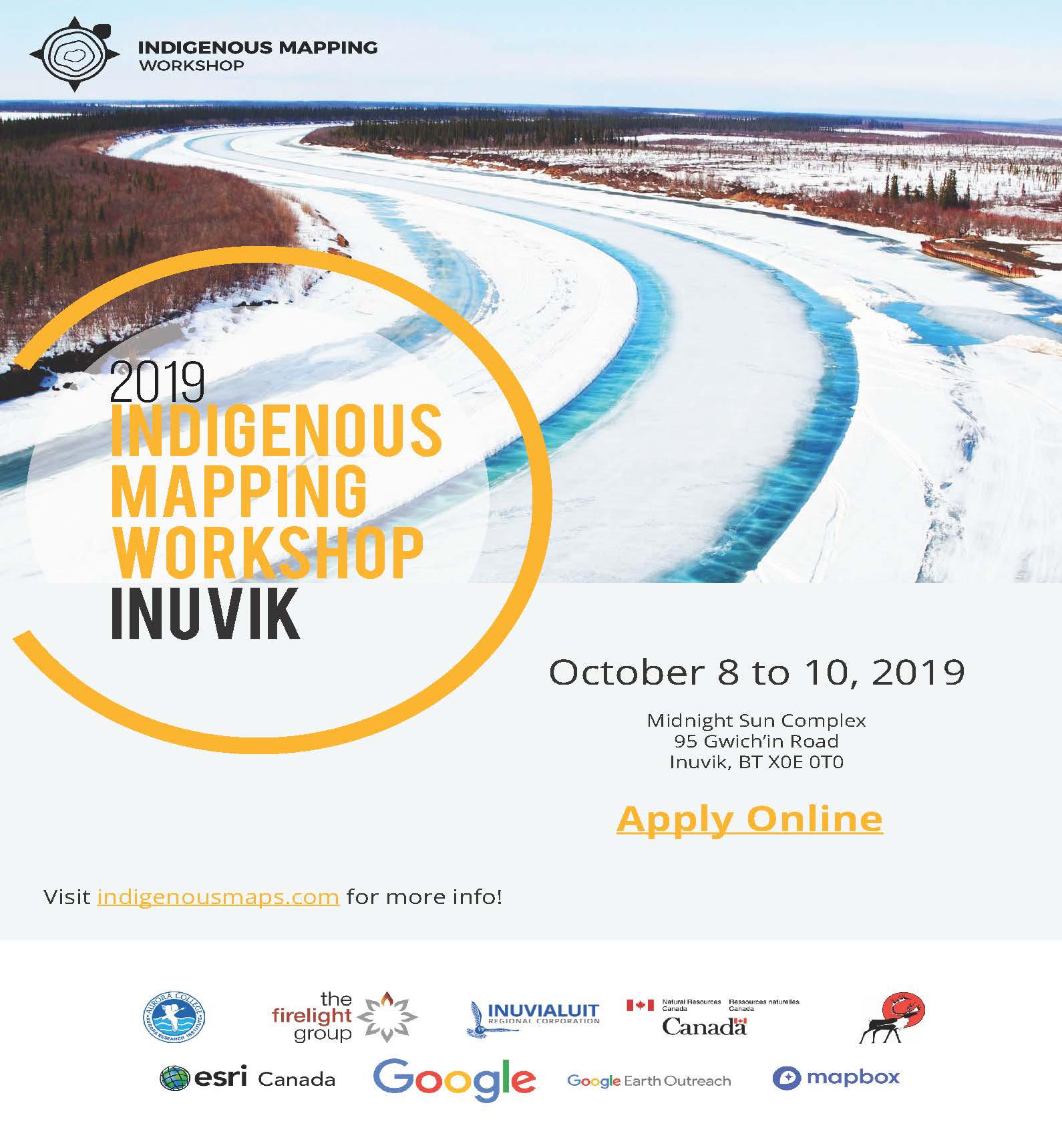
Indigenous Knowledge and GEM Data Integration Workshop
ARI Team:
Overview:
Develop and host in Inuvik, Northwest Territories a 4-day Indigenous Mapping Workshop, which will welcome over 100 Western Arctic community members. The workshop will provide northern communities with innovative training and opportunities to utilize geoscience/spatial data, methods, and tools for community-based activities.
The workshop will enhance northern capacity and empower northern communities in culturally appropriate and relevant ways to inform decision-making. Members are provided with the opportunity to learn and share best practices, and receive hands-on training on geospatial tools used to collect, host, visualize, share, consume data (e.g. GEM data), and publish community-generated spatial data.
At the end of the workshop participants will be aware of and trained in the use of a variety of geospatial tools (e.g., Google, Esri, and QGIS) to support climate change monitoring; northern knowledge capacity and decision-making; knowledge exchanges between Indigenous communities; the integration of geoscience and geospatial data.

Objectives:
- Grow geospatial awareness in Western Arctic Communities.
- Grow geospatial capacity in the Western Arctic.
- Grow the awareness of current and potential use of geoscience data in Western Arctic Communities
- Deliver training on geospatial tools to Western Arctic Community members.
Methods:
The workshop will deliver training on geospatial applications and tools through:
- Tutorials
- Round table knowledge exchange and
- Hands-on training
Schedule:
| Task Number | Task | Outputs |
|---|---|---|
| 1 |
Planning committee development April-May 2018 |
Workshop planning committee in place |
| 2 |
Event logistics and coordination May 2018-November 2019 |
|
| 3 |
Outreach and communication strategy July 2018-September 2018 |
Outreach and communication strategy |
| 4 |
Needs assessment and analysis October 2018-December 2018 |
|
| 5 |
Participant application and event registration January 2019-February 2019 |
Website developed for application and registering of participants Successful applicants informed |
| 6 |
Curriculum development January 2019 – March 2019 |
Draft curriculum presented to the planning committee to ensure it is compliant with needs analysis and provides culturally and appropriate geospatial training. |
| 7 |
Curriculum review April 2019 –June 2019 |
Approved Curriculum |
| 8 |
Workshop Delivery October/November 2019 |
A dynamic mix of indigenous mapping presentations, hands-on training, and knowledge exchange among participants in using and applying geospatial/geoscience technologies is delivered. |
| 9 |
Post-workshop Evaluation and reporting November 2019 |
Workshop report |
External Partners:
NRCan: Geo-mapping for Energy and Minerals (GEM) Program