ARI Team
Overview
Permafrost provides a foundation for ecosystems and Northern communities. Therefore, as climate warms, the permafrost can thaw and this is the primary cause of climate-driven landscape changes in the Western Arctic. Models project that the climate will continue to warm, therefore, it is expected that the permafrost and thus, the landscape of the Western Arctic will continue to be affective negatively.
The physical characteristics of the permafrost dictate how landscapes will respond to warming, as well as the environmental, biogeochemical and infrastructure impacts. Therefore, understanding this is critical to inform societal adaptation and to predict ecosystems’ responses.
Currently, this type of time information is not readily available at large scale (i.e., at the local level e.g. the Beaufort Delta region). Existing knowledge on terrain sensitivity are mainly spatially discontinuous and are at small scales which are not of sufficient quality or resolution to inform science or decision making at local scales.
Objectives
This project is a part of a larger initiative which aim at developing a NWT wide, empirically-based map products describing the sensitivity of permafrost terrain. The goal of the project is to support the NWT wide initiative through the development of empirically-based map products describing the sensitivity of permafrost terrain in the Western Arctic.
The aim will be achieved through the pursuant of the following objectives:
- Contribute to the development and implementation of a collaborative approach to generate NWT-Wide thermokarst and permafrost feature inventory maps;
- Participate in mapping permafrost train; and
- Build permafrost terrain sensitivity products of the Western Arctic.
Location
The efforts of the larger initiative will involve developing methods and implementing mapping efforts around the 33 NWT communities and eventually extending to the entire NWT and adjacent Provincial/Territorial transboundary watershed areas. However, ARI’s contribution will focuses on the areas surrounding the Western Arctic communities.
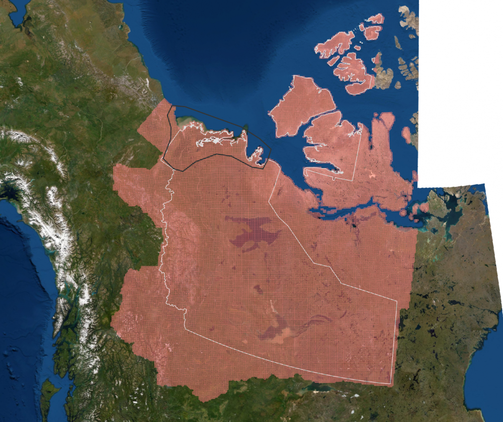
Figure 1: Area of the Thermokarst Mapping Project (NWT Border Marked in White). ARI’s Initial Project Area Marked in Black.
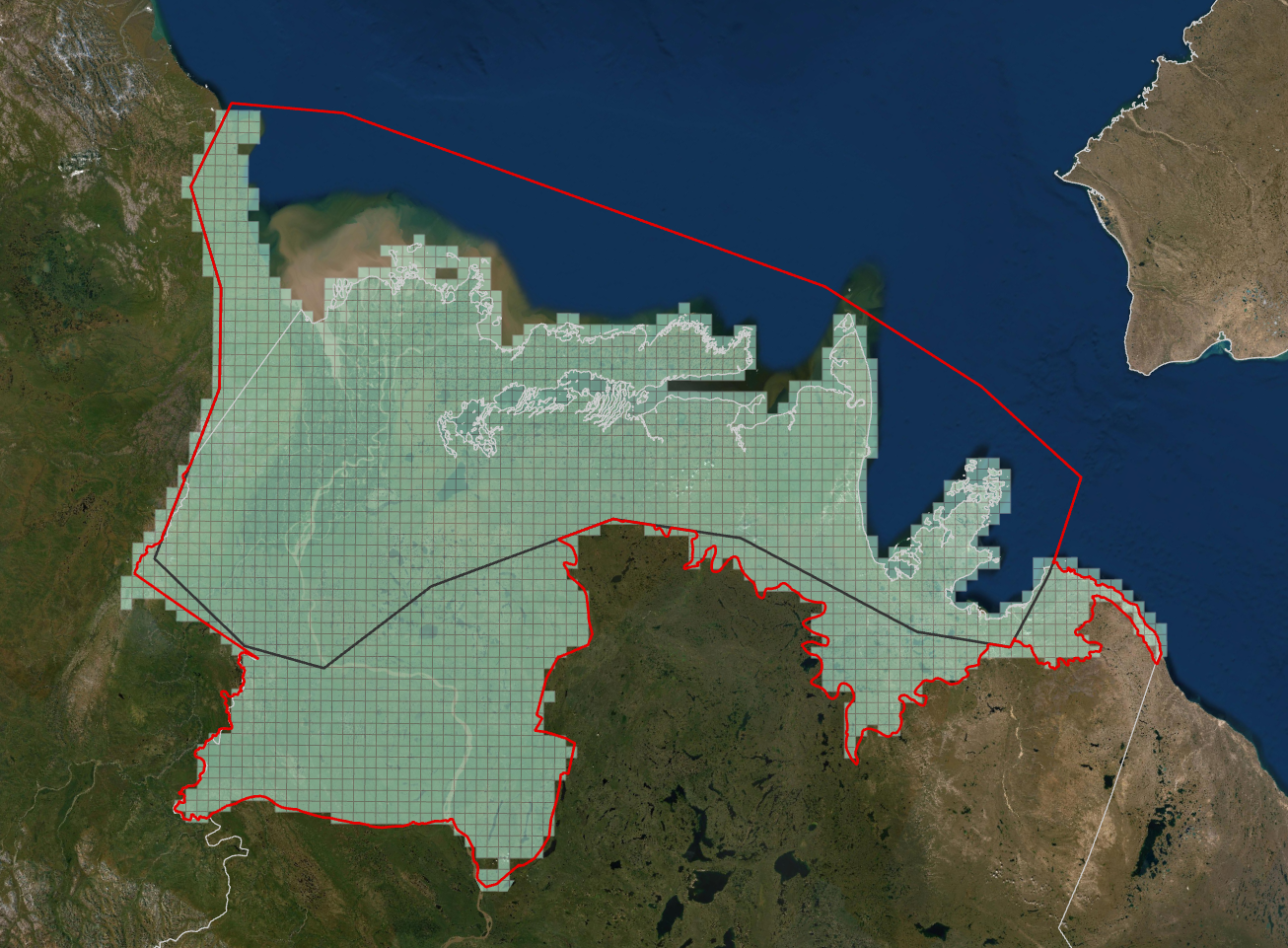
Figure 2: The New ARI Mapping Area Depicted by Red Line: additional cells were added to include entire ecoregions.
Methods
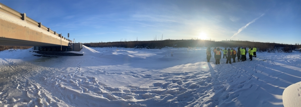
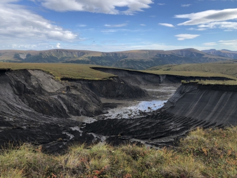
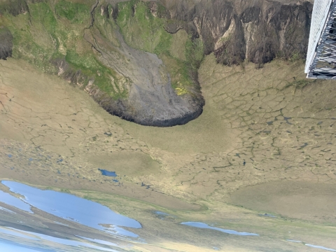
The study region was broken down into some 41,000 cells in a grid pattern. In each cell, the thermokarst features were assessed and inventoried in accordance with pre-determined attributes in the themes: mass wasting, hydrology, and periglacial. The mapping was carried out in a GIS and was primarily based on 2017 satellite imagery, with supporting datasets to track changes and validate observations. Aerial surveys will additionally be used to measure the accuracy of the mapping data. Analysis and QA/QC will be led by the NTGS, ARI will then develop communication products to disseminate the results to Western Arctic communities.
Schedule
| Q1 | Q2 | Q3 | Q4 |
| Year 2019 - 2020 | |||
|
|
|
|
| Year 2020 - 2021 | |||
|
|
|
|
| Year 2021 - 2022 | |||
|
|
|
|
External Partners
Steve Kokelj, Northwest Territories Geological Survey
Alice Wilson, Northwest Territories Geological Survey
Northwest Territories Environment and Natural Resources
Keywords
Permafrost, Thermokarst, Mapping, Geographic Information Systems, Thaw Slump, slumping, slope movement, Landslides, Hydrology, Periglacial Processes, Permafrost Mapping, Permafrost Thaw, Remote Sensing, Satellite Imagery
Updated May 2021