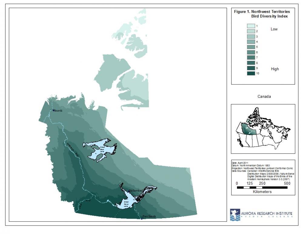
ARI has participated in a biodiversity assessment for the Northwest Territories (NWT) to assist with future land-use planning. The biodiversity project is a way to assess the variety of life at the genetic, species and ecosystem levels. The first part of this analysis, a bird diversity index, is shown in Figure 1. This index is based on the number of birds found in different parts of the NWT. The numbers of bird species present in different areas were grouped into 10 equal interval classes to arrive at the bird diversity index.
 Looking at different kinds of organisms will provide a better measure of biodiversity. As it is not possible to assess all genes, species and ecosystems in a region, ‘surrogate indicators’ can be used as stand-in evaluators of biodiversity. So, a mammal species diversity index map was created to show what parts of the NWT have higher mammal diversity (Figure 2).
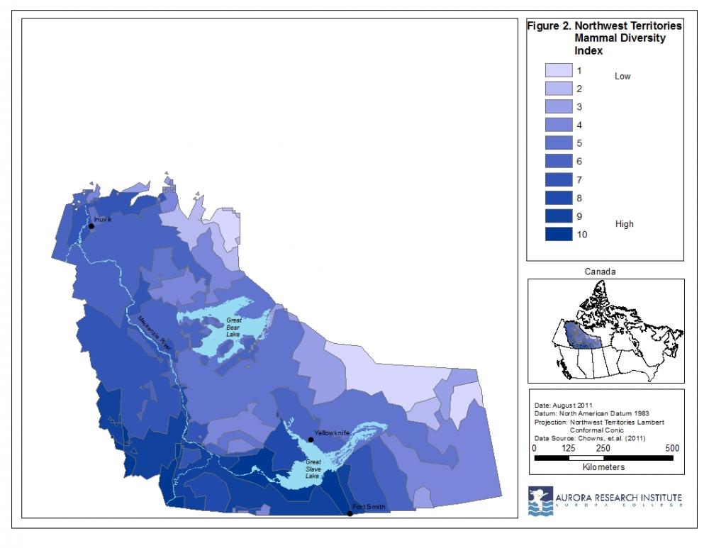
By knowing where diversity is high, it is possible to avoid these sites in future resource developments or create protected areas.
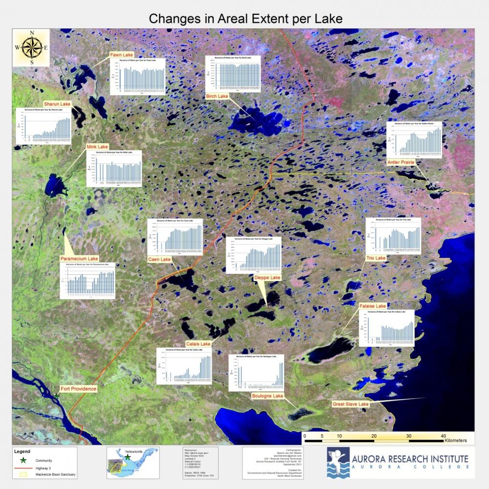
Another current project is assessing how the surface area of lakes in and around the Mackenzie Bison Sanctuary (MBS) are changing. Lakes in this area are flooding, causing a reduction in available forage for bison in the MBS. Graphs in the figure below show the changing surface areas of twelve lakes over a sixty year period in and around the MBS.
ARI has also worked to produce maps with Karen Dunmall, a PhD student at the University of Manitoba, studying salmon in the Canadian Arctic in collaboration with Fisheries and Oceans Canada. Below are maps showing catch locations in the NWT for chum, sockeye, pink, chinook and coho salmon.
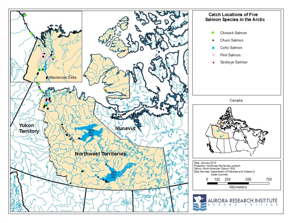
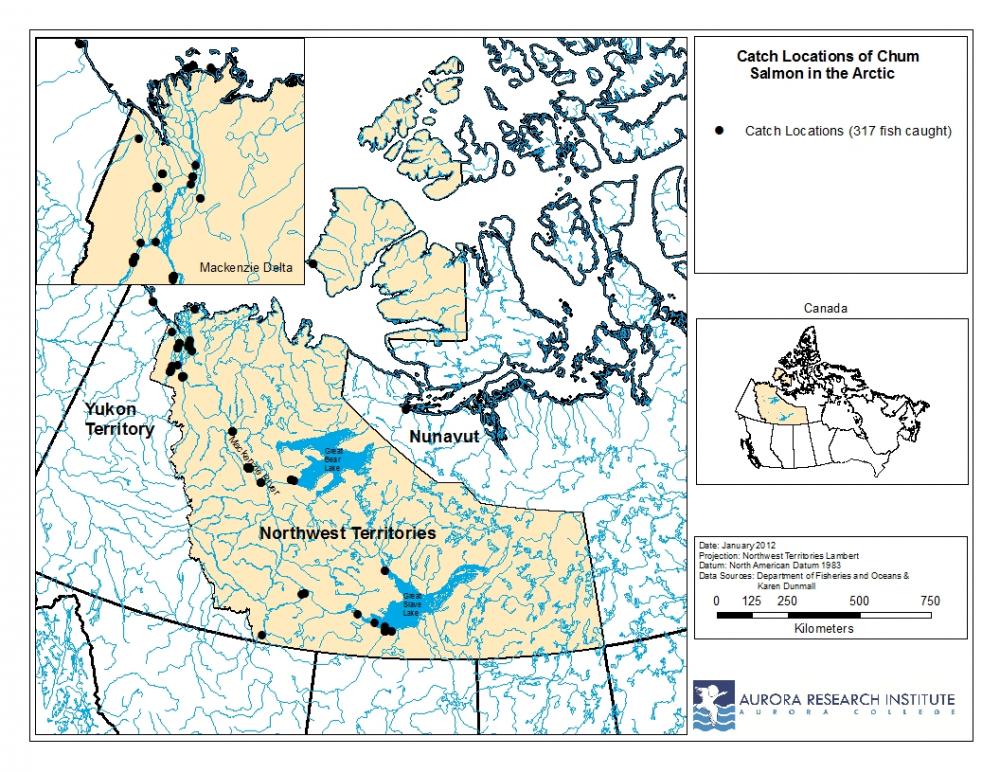
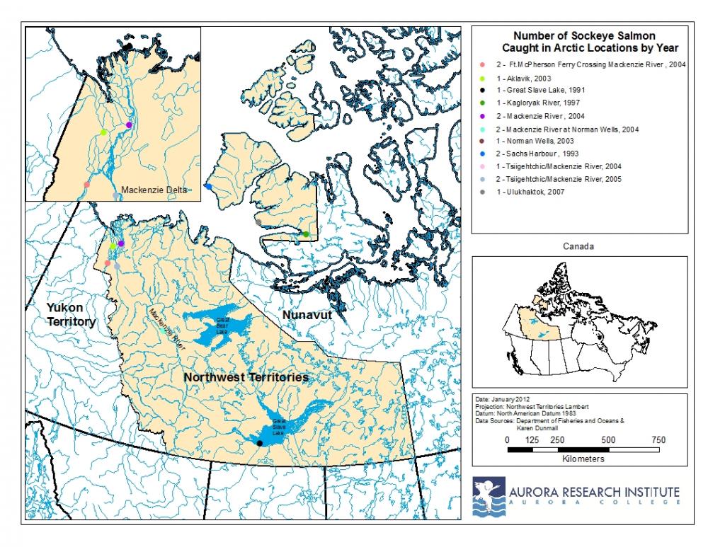
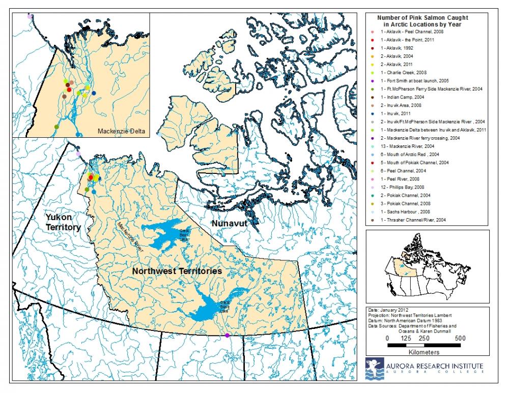
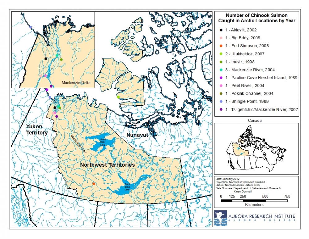
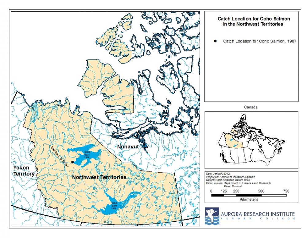
For more information about Ms. Dunmall’s work visit her web site at www.arcticsalmon.ca.