Main Project Contact:
Garfield Giff
Project Start Date:
March 2018
Project End Date:
March 2021
Project Name:
A Geographic Information System (GIS) to Support the Development and Implementation of Mineral Strategies in the Western Arctic
ARI Team:
Garfield Giff
Celtie Ferguson
Overview:
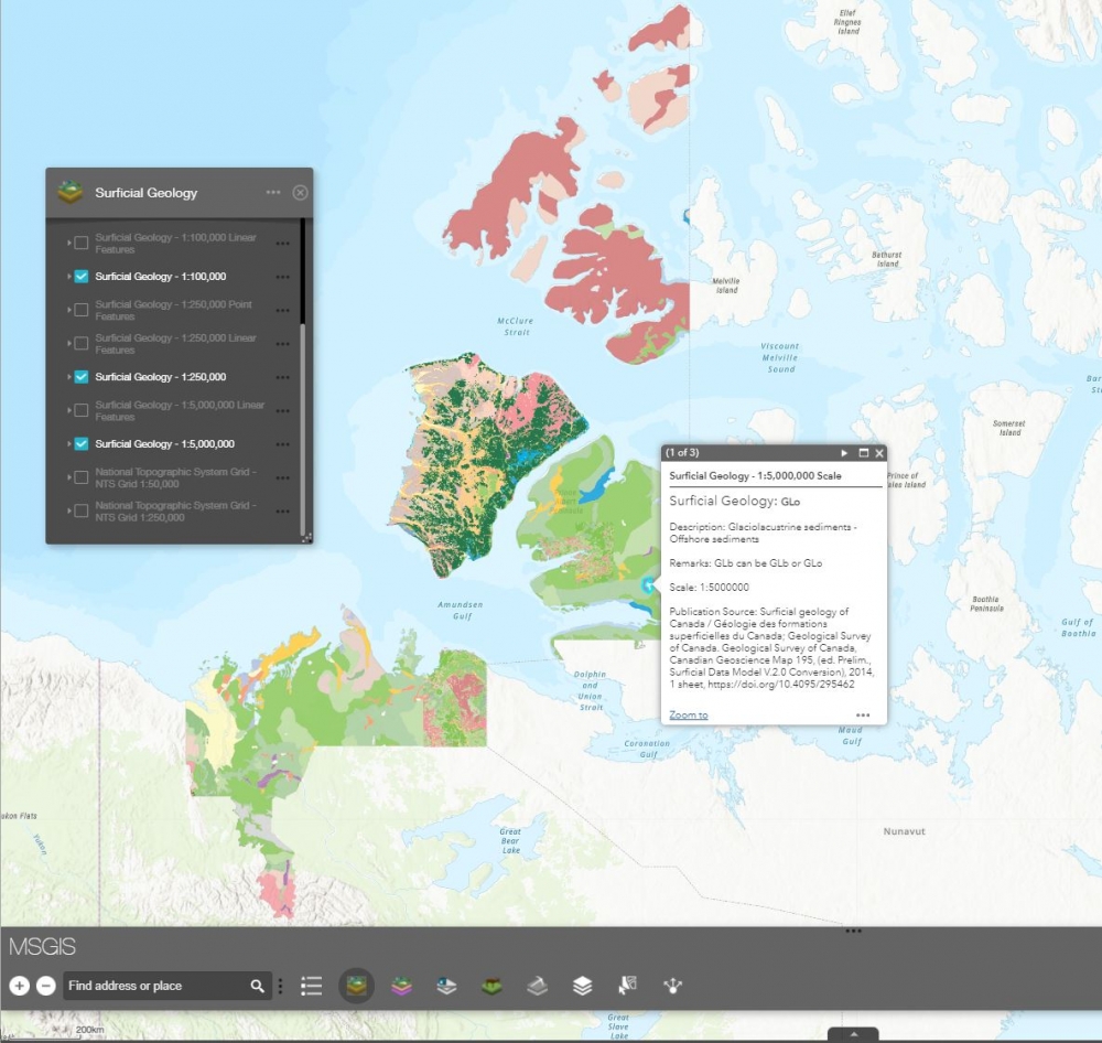
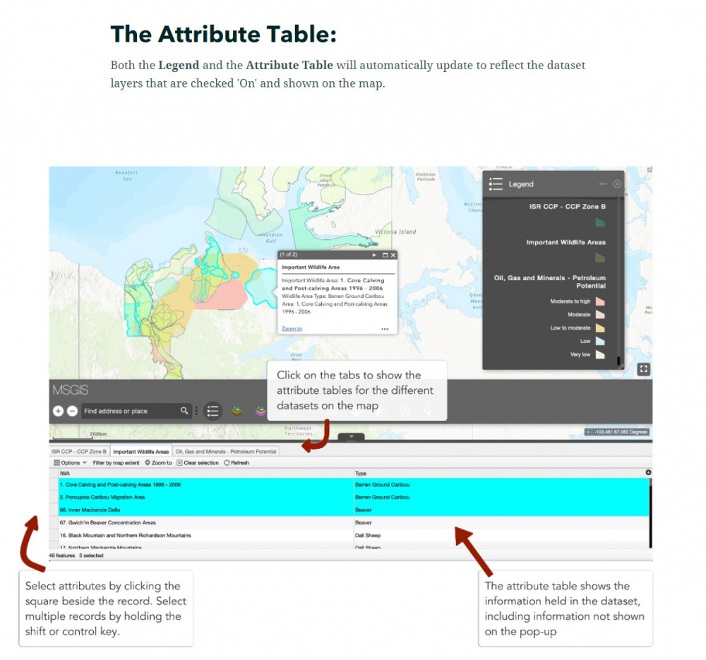
The GIS for Supporting Mineral Strategies in the Western Arctic (MSGIS) is an interactive online tool designed to bring together meaningful, current, and accurate data in order to support well planned, eco and community friendly investment in mineral exploration.
The tool is designed to allow anyone to explore the geology of an area while also examining the intersecting land use zoning data, environmental data, and oil, gas and mineral data. This includes special use areas, conservation areas, existing oil, gas, and mining leases, and species at risk ranges - among other datasets.
Objectives:
The aim of the project was to design and implement a GIS for the Western Arctic communities that integrates geoscience data with Western Arctic specific spatial and non-spatial data to visualize, analyze, identify, store, format, and present critical information to support the management of mineral strategies.
This project, the GIS for Supporting Mineral Strategy Development (MSGIS), aims to provide the decision-makers of communities with vital independent information to support decision making concerning the development, implementation, and maintenance of mineral strategies.
Location:
The GIS to Support the Development and Implementation of Mineral Strategies in the Western Arctic focuses on the Western Arctic, the region of the Northwest Territories north of 64° N. This includes the entire Gwich’in Settlement Area and Inuvialuit Settlement Region.
Methods:
The MSGIS commenced with consultations as to what would be relevant datasets one would include in decision making regarding mineral strategies. These datasets (such as land use plans, community conservation plans, and ecology) were then sourced and brought into the MSGIS, alongside new and updated geoscience datasets published through NRCan’s GEM program.
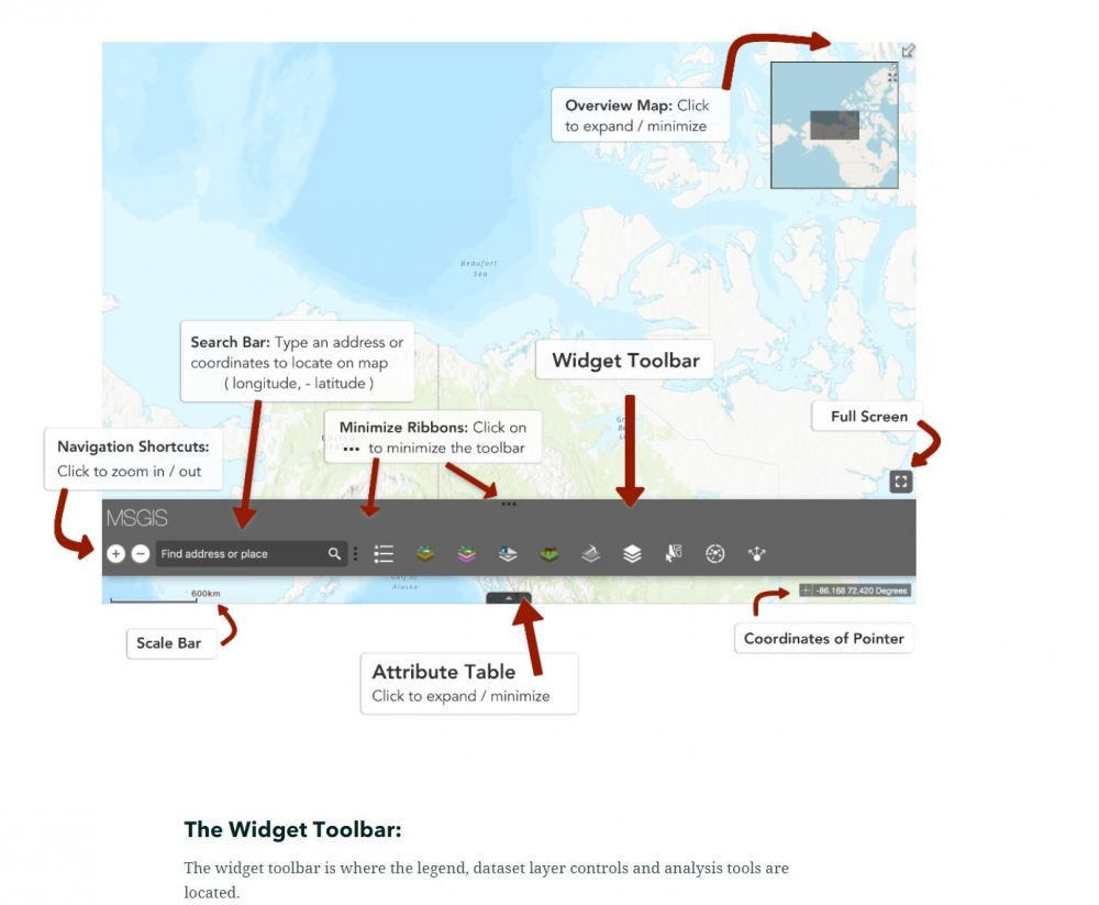
The MSGIS web page, web mapping application, and user guide were then built and made publically accessible online. https://msgis-nwt.maps.arcgis.com/
The following methodologies were used:
- Stakeholder engagement;
- Project management;
- Data and Literature Review;
- Data Collection;
- GIS Development (architecture and implementation);
ARI will continue to provide access and training for the MSGIS project.
Schedule:
| Q1 | Q2 | Q3 | Q4 |
| Year 2018 - 2019 | |||
|
|
|
|
|
| Year 2019 - 2020 | |||
|
|
|
|
| Year 2020 -2021 | |||
|
|
|
|
On November 16, 2020 the MSGIS tool was made publicly available. On November 19, 2020 ARI staff held a webinar giving stakeholders and the pubic a chance to have a demonstration and view application of the MSGIS tool.
View the MSGIS tool here
Media:
External Partners:
NWT Centre for Geomatics
NWT Geological Survey
Department of Industry, Tourism, and Investment; Petroleum Resources Division
Geo-mapping for Energy and Minerals
Keywords:
Western Arctic, Mineral Strategy, GIS to Support Mineral Strategy, Integration of GIS and Geoscience Data
Updated May 2021
