Main Project Contact:
Garfield Giff
Project Start Date:
March 2018
Project End Date:
March 2020
Project Name:
Using Remotely Piloted Aircraft Systems (RPAS) Technology to Map and Monitor Earth Movement Along the Caribou Hills, Inuvik, NWT
ARI Team:
Greg Elias
Garfield Giff
Celtie Ferguson
Edwin Amos
Past Team Members:
Eric Cheyne
Overview:
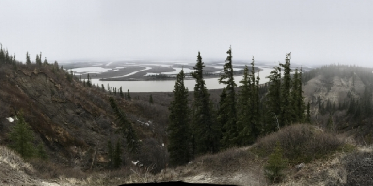
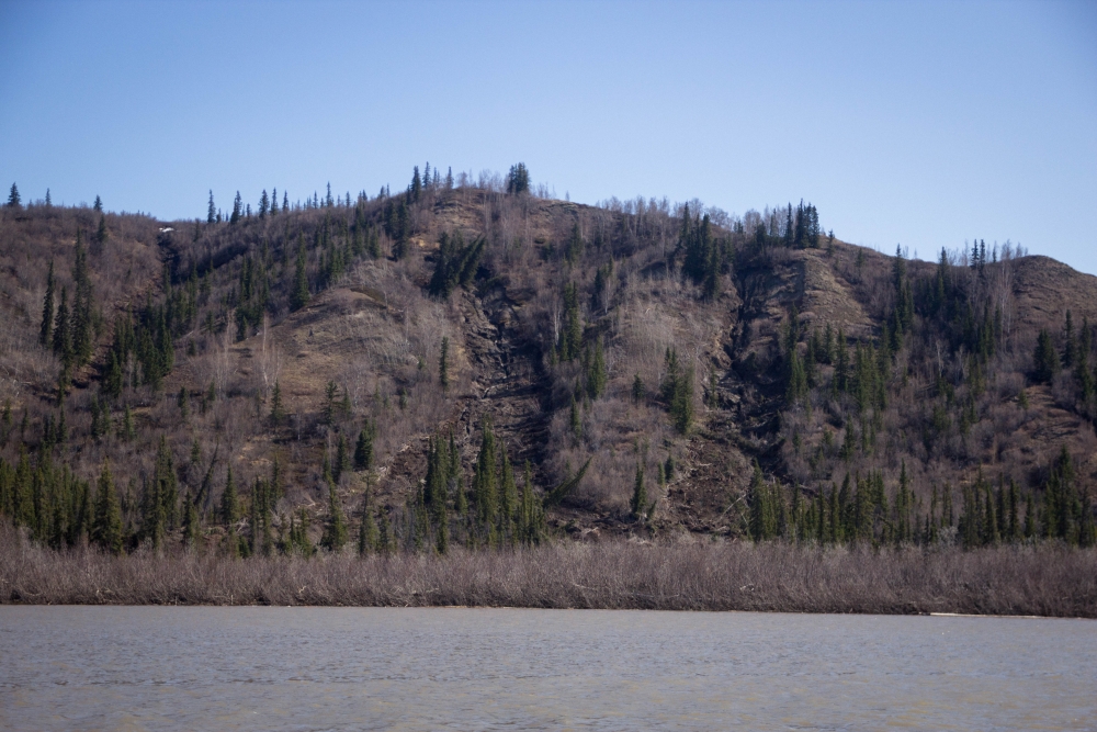
Climate driven changes are affecting the landscape and the way of life of the people of the Northwest Territories (NWT). These effects on the landscape are visible along the coastlines, inland to the valleys, water channels, and along the slopes. To mitigate against these changes and to protect infrastructure, people, and wildlife it is important that the necessary tools are available to support the development and implementation of climate change adaptation measures. This project aims to develop and make available one such tool in the form of online hazard maps.
The maps will cover the Caribou Hills, in particular the section within the vicinity of Reindeer Station. This is an area of concern to the community due to the frequency in landslides and slumps. The NWT Geological Survey reported 80 landslide events in September 2017 along a 20km stretch of the Caribou Hills. The previous recorded high was 25 landslides in October 2009.
Objectives:
The main objective of the project is to develop and disseminate hazard maps and additional information (spatial and non-spatial) to support the development and implementation of climate change adaptation strategies for the Caribou Hills. This information will be available to inform: regulations, vulnerability assessments, infrastructure activities, transportation, hunting and trapping, fishing, and other recreational and wellness activities along the Caribou Hills, as well as support the NWT Geological Survey planned geohazard mapping and geohazard risk assessment surveys. For example, the IRC could use the information to support more informed decision making on future planning for the cabins at Reindeer Station.
Location:
The research area spans a 2.5 km stretch of the Caribou Hills (68.67°, -134.12°; 68.69°, -134.14°) which rolls along the East Channel of the Mackenzie River between Inuvik to the south and Tuktoyaktuk to the north. A key focal point of the research site is Reindeer Station (Latitude 68.69° and Longitude -134.14°) a NWT historic landmark and an Inuvialuit wellness and cultural camp.
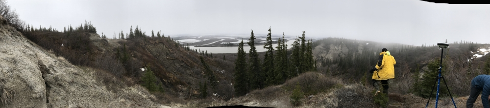
Methods:
The project team will utilize a number of different methodologies in the pursuant of the objectives. This will include but not limited to the following:
- Community Engagement and Project Planning;
- Project Planning and Project management;
- Data and Literature Review;
- Data Collection;
- GIS Development (architecture and implementation);
- Data analysis;
- Simulation Modelling;
- Information Dissemination
The results of the project will be communicated and disseminated using the following:
- Scientific publications;
- Plain language reports;
- Maps and charts;
- StoryMaps;
- Workshops;
- Oral and poster presentations; and
- Through the IRC’s Portal.
Schedule:
| Q1 | Q2 | Q3 | Q4 |
| Year 2017 - 2018 |
|
||
|
|
|
|
|
| Year 2018 - 2019 | |||
|
|
|
|
| Year 2019 - 2020 | |||
|
|
|
|
| Year 2020 - 2021 | |||
|
|
|
|
| Year 2021 - 2022 | |||
|
|
|
|
External Partners:
Inuvialuit Regional Corporation
Inuvik Hunters and Trappers
NWT Centre for Geomatics
NWT Geological Survey
Climate Change Preparedness in the North
Keywords:
Hazard mapping, Drone survey, GIS, Remote sensing, Landslides, Slumps, Climate change
updated May 2021